I woke up to the calm after Storm Doris (or Doris Day, as many people called it!). It wasn’t that bad as far inland and south as I am, but it was loud and wet. Puppy needed a lot of coaxing to go do her business!
I had no work in the queue, so I thought of doing another self-guided walk. But, of course, I woke up to a large, difficult job available to me if I wanted it. I’ve been having trouble getting work with this client during the week since I’ve been in Europe because of the time that work is assigned, but if there’s anything for the weekend, I tend to get it as I appear to be the only one who regularly works at that time. So the client assumed I’d want it and gave me both a bonus and an extension as an incentive. So of course I accepted it and thanks to the extension, I could still take today off. I’ve been sleeping really poorly the last few days and just had my first decent night, so I should be raring to go on the job tomorrow.
I did all the Puppy stuff and put her away for a nap around 9:30, then headed out. The morning was bright, but cold. I passed the perfect car for me along the way…
Coming into downtown, I was more than a little peckish since I’d had a super light breakfast. I decided to pop into Greggs for a coffee to warm my hands and a sausage roll as a second breakfast. Think of Greggs as being about as close to Tim Hortons or Dunkin’ Donuts as one can get in the UK. They have sandwiches, soups, baked goods, and reasonably priced coffee. I was disappointed that the combo would be more than it was in Manchester, according to the menu, but, no, it was still £2. It’s almost not worth getting a sausage roll if you get a coffee!
I munched my treat as I headed to the Music Hall/Shrewsbury Museum. Outside of it, I spotted an exhibit I either missed the other day or which is new. It’s a bunch of photographs from all over the world showing the many facets of humanity.
Some of my favourites included this one from a Soviet prison, in 1988…
…this hilarious scene from New York City…
…a sad-looking Canadian couple…
…a Tanzanian family…
…and Japanese folks enjoying the artificial beach in Ocean Dome, Miyazaki.
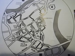
It was then time to start the tour. It covered most of downtown in a very logical, but twisty sort of manner and there’s no way to make a Google Map that would make sense of the tour. Here’s the very detailed map provided in the brochure. If you open it in another tab, it does so to full, legible size. I will number each of the stops so you can follow along if you want.
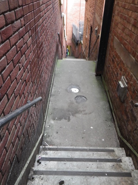
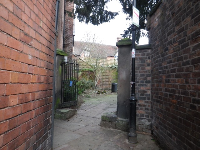
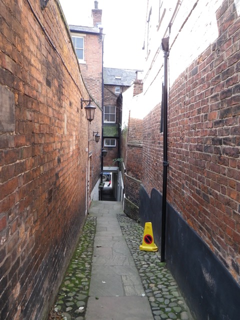
So today’s self-guided stroll was about Shrewsbury’s shuts. “‘The Shuts of Shrewsbury are a notable feature of the topography of the town.’ So wrote L.C. Lloyd in 1937. For those unfamiliar with the word, ‘shuts,’ they are called snickets, ginnels, chares, alleyways, entries, wynds, weinds, wiends, twitchells, opes, and twittons in other towns. In other words, they are narrow passages connecting one street to another. True shuts must be open to the public, used mainly on food, and should not be culs-de-sac. Other desirable qualifications are that they are ancient and between walls, with steps, archway(s), and a corner or two. … Many of the shuts have disappeared and most of the survivors have exchanged their picturesque (or scurrilous) ancient names for something more genteel.”
Let me tell you, the £1 price for this guide felt like a bargain! I was curious about the various passageways I’d seen through town, but had no idea if they were open to the public or not. I was off on a wonderful adventure!
My first stop was Gullet Passage (1). “‘Gullet’ means a water channel and, in fact, this shut follows the course of a former stream that was drained from a peat bog. This was filled in to make a new market place, which eventually became The Square.”
Phoenix Place/Passage (2) was unmarked. I was grateful that the brochure had pictures of all the entrances so it was easy to spot them. Whomever made these brochures should be commended.
“As this shut widens, note the remnants of doorways and fire-places in the brickwork. These are the remains of the 19 houses recorded here in the 1851 census, a warren of unhealthy dwellings in a crime-ridden area.”
“From this wide section the shut narrows again to dive under timber-framed buildings.”
The entrance on this side is well marked.
I passed the King’s Head Inn, which dates back to 1404.
Right after the inn is King’s Head Passage (3).
“As the shut leaves the inn, it curves round, as did all the shuts in this low part of town, and runs toward the river. In times of flood, water collects at its lowest point, where the town ditch was cut across it in medieval times.”
Looking back.
Emerging into blessed sunshine and blue sky.
I ended up on Smithfield Road and my attention was drawn to a plaque at the corner of Mardol, which has information about the Welsh Bridge.
The original bridge is gone, of course, but here stood one of Shrewsbury’s oldest bridges. It was built of stone, likely shortly after the Norman Conquest of 1066. It was then known as St. George’s Bridge. “Legend has it that in 1485, Thomas Mytton closed the bridge to Henry Tudor (later Henry VII), who was on his way to fight Richard III at Bosworth. Mytton declared that Tudor could only enter Shrewsbury ‘over his lifeless body.’ Forced to compromise, Mytton lay down and Tudor entered the town by stepping over him.”
Floods rendered the bridge unsafe in 1672. Some repairs were carried, but in 1795, St. George’s Bridge was replaced by the current Welsh Bridge.
“St. George’s Bridge provided the Welsh with important access to the English wool market, a trade that made Shrewsbury very wealthy.”
The other side of the plaque has information about Mardol. “Like much of Shrewsbury, Mardol has a hidden history. Behind its brick façades are complete timber-framed medieval buildings, traces of Saxon stonework, and Shrewsbury’s ancient ditch and wall defences. In Saxon times (900AD), Mardol was home to tradesmen who gained access to the river via long curving gardens. … By the 15th century, Mardol was home to wealthy merchants living in fine, timber-framed houses. Many of these were extended and brick faced in later centuries. … By the 17th century, Mardol had become the town’s red light district, providing drinking and whoring for the river boatmen and their crews. Today, it’s a thriving commercial street in Shrewsbury’s historic centre.”
Carnarvon Lane (4) was my next stop. You can see the entrance in the picture above, the rounded arch nearest the car.
“Ludovick Carnarvon lived here in 1460.”
I passed a lot of these tiles on my walk, but could not find anything about them.
“Rowley’s Mansion, one of the earliest brick houses in Shrewsbury, built by a wealthy draper and brewer in 1616-1618.”
Darwin’s Gate sculpture.
After a few turns, I came to Drayton’s Passage (5).
These dog heads “represent the Talbot breed, used for hunting in the 18th century, and provide a reminder that this was once The Talbot, a bustling and competitive coach inn at that time.”
This brought me back to the Music Hall, but I was only getting started!
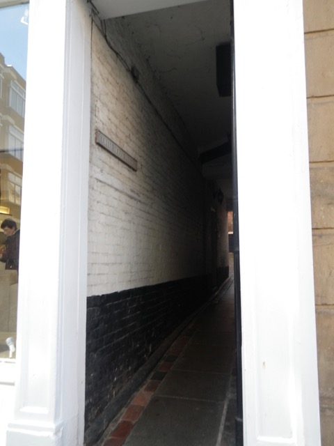
Next to the Music Hall was the Coffee House Passage (6).
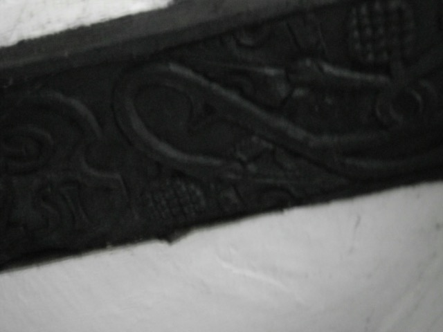
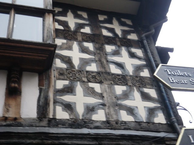
There is an intricately carved beam overhead. Is that a pineapple?
I love how the doorframe compensates for the crooked building.
More tiles. I looked up and didn’t see much…
I emerged to this pretty sight:
The tour then took me across Old St. Chad’s Churchyard. “The church was founded by King Offa, and is mentioned in the Domesday Book.”
Once again, the pamphlet directed me to an informational plaque I would have otherwise missed.
“The Church where Shrewsbury began? Many believe that here, on one of the two hilltops in the loop of the RiverServern, stood Pengwern, the court of the Princes of Powys (7th century AD). We know that by the reign of Offa, King of Mercia (757-96), there was a monastic college on this site. In 1148, it was replaced by a much larger church, which extended from Belmont to College Hill. … The building in front of you is known as ‘Lady Chapel.’ It is the only standing remains of the church, after it collapsed sensationally in 1788. Four years later, new St. Chad’s church was built near the quarry.”
This plaque had a wonderful timeline of key moments in Shrewsbury history. Here are some highlights:
901: First written reference to Shrewsbury as ‘Scrobbesbyrig.’
1068: Shrewsbury Castled built by Norman invaders.
1148: Found of Old St. Chad’s Church.
1216: Henry III orders the construction of town walls.
1349: Black Death kills half of European population.
1403: Battle of Shrewsbury.
1645: Capture of Shrewsbury by the Parliamentarians.
1788: Collapse of Old St. Chad’s Church.
1809: Birth of Charles Darwin in Shrewsbury.
1918: Wildfred Owen dies in WWI.
Wilfred Owen? A poet best remembered, by me at least, for his poem “Dulce et Decorum est.” I actually used to know it by heart.
I then noticed this plaque by a tree and it made me tear up. “In memory of Nigel Johnson, who lost his life whilst carrying out his duties on behalf of the people of Shrewsbury. A tree for a tree man.”
I then had to turn onto Belmont Bank, a part of which I walked on the medieval tour. In 1610, it was Back Lane, a name that was in use until the 1950s.
Next up was Barracks Passage (7), which we’ve been to before.
This passage was called Elisha’s Shut in 1725. “The long range of timbered buildings on the right contains timbers felled in 1426.”
This projecting window might have been for a tallyman to log the carts in and out of the passage.
A very short distance away is Compasses Passage (8), named for the Compasses Inn that stood on the site in 1880. “An old tale tells of a bull on its way to market straying from Wyle Cop and getting stuck in this narrow shut.”
You emerge on Belmont Bank. You can see Barracks Passage up the hill (the arched doorway before the red door).
On the way to my next stop, I passed a violin maker. Vicki, have they got a violin for you! 🙂
This private shut on Wyle Cop is not a numbered item on the list. It’s just big enough for a packhorse to enter the yard.
“The Lion [was] a notable competitor of The Talbot for the coaching trade in the 18th century.” Just across from it up and up a bit around the bend was my next turn, Dogpole.
The name of this shop caught my eye as it sounds familiar.
Does Wysteria Lane mean anything to any of you?
The unnamed shut in front of Dogpole House (9) was my next stop.
It brought me back to St. Alkmund’s Square, where we’ve been a few times.
I liked that this stroll brought me back to places I’d been from a different direction, offering me a chance to see them with fresh eyes.
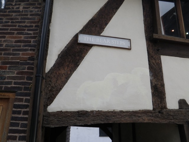
I went back down the Bear Steps (10) and then turned right to come right back up to the edge of St. Alkmund’s Square so I could turn onto Butcher Row.
“There were 15 butchers’ shops here in 1828, and Abbot’s House still retains some of its meat-hooks and ancient shop fronts.”
Pride Hill, the pedestrian street, is at the end of Butcher Row. I turned right and went just past the Darwin Shopping Centre to a shut called 70 steps (11). “This is the last remaining shut of the four that used to link Pride Hill to the meadows at the bottom of the slope, beyond the town wall. When the shopping centre was built, the shut was incorporated, providing a long, dark, and uninviting descent, which we do not recommend.”
I just peered in, as they instructed, and continued on Castle Street (Pride Hill becoming it in the direction of the train station) and found, thanks to their picture, Castle Court (12). “Here is an inviting cluster of houses and flats, those on the left converted from a chapel and those on the right once part of the old County Gaol and House of Correction.”
For this one, I had to turn back and go the way I came, to Castle Street, and continue along to School Gardens (unnumbered), “once part of Shrewsbury School,” which Charles Darwin attended. Yes, another scaffold. There are a lot of construction works going on in Shrewsbury. Must be all the old buildings keeping everyone employed.
This courtyard was part of the old goal and was “the quadrangle used by prisoners for exercise.”
I continued along to emerge at the Darwin statue in front of the library and archives.
I then circled back around up Castle Street (towards Pride Hill) and found St. Mary’s Shut (13). “This has the longest covered section of all the shuts in Shrewsbury and is very narrow and dark.”
The brochure told me not to miss the second part of it, across a carpark, but I was disappointed that there was scaffolding blocking it. Thankfully, I was able to access it from the other side.
This part of St. Mary’s Shut “is probably the narrowest in England with a minimum width of 56cm. Old maps show the shut closed in by buildings throughout its length.”
This brought me to St. Mary’s Place. I circled around the back side of St. Mary’s Church.
St. Mary’s Court is #14, but there wasn’t really anything to photograph.
Here I am emerging from it onto St. Mary’s Street, with Church Street directly opposite, which I took.
This brought me back to St. Alkmund’s, where I followed the path (15) to the La Lanterna restaurant, where I had a nice lunch the other day. Here’s its entrance.
I went down the stairs and turned right on Wyle Cop (Barracks Passage, etc. is to the left). Next up was another place we’ve been before, Golden Cross Passage (16). Let me tell you, I was seriously tempted by that affordable sushi, but I’d been out for a few hours and it was getting close to Puppy’s lunch time.
Emerging from Golden Cross, I turned right on Princess and then right again into Peacock Passage (17).
Of note in this shut is that you can see the spire of St. Alkmund’s Church. The effect was rather impressive.
At the end, you cross the High Street (difficult unless a cute delivery guy stops to let you cross) to get to Bank Passage (18).
It used to have more steps.
More tiles.
You emerge on Fish Street below St. Alkmund’s Church.
Looking back down Bank Passage.
Looking down Fish Street.
Do you know where you are? The Bear Steps are to the right after this building and Grope Lane (19) is to the left.
Bear Steps yet again.
And back to Grope Lane, which was the first stop on the medieval tour.
I emerged on High Street. Market Place and the Music Hall are to the left. I continued ahead to Pride Hill.
I passed a bookstore along the way. I need this book.
I turned right on Pride Hill and popped in at Tesco’s for a few things, including some mediocre sushi for lunch. I haven’t had proper sushi yet in England, so that’s something I definitely intend to do before I leave. The place I passed today is apparently really good and has very reasonably priced lunch specials.
I hope you enjoyed this tour of Shrewsbury’s shuts as much as I did! I have one more tour pamphlet left, but I may go buy more since I have almost two weeks left here. Let’s hope the weather holds up!


