The Victorians in Shrewsbury, a Self-Guided Walking Tour

Having completed the Tudor tour of Shrewsbury, I headed back to the Music Hall to commence the Victorians in Shrewsbury self-guided walking tour.

“Queen Victoria reigned from 1837 to 1901. These were years of peace, prosperity, population growth, invention, and expansion. Shrewsbury was not one of the boom towns and, although some working class estates and substantial middle class villas were erected in the suburbs,” the tour was limited to the town centre and its then new public and commercial buildings. “Many were built of high quality materials and were very varied in style because, of course, architectural styles did not change with the new monarch. Queen Victoria’s reign was also a time of greater regulation, moral certainty, growth of religious non-conformity, and considerable philanthropy.”

So the first stop was the Music Hall itself, where we finally get some information about it. It was “built in 1838-40. It looks classical and Greek and was known at first as Shrewsbury Public Rooms. It was built around a shut that led to a yard where engines of the Salop Fire Office were kept; this is now the entrance to the museum. The Music hall, with a choir and orchestra gallery, was to the left. The hall could seat nearly 800 and was also used for balls, banquets, lectures, meetings, and bazaars. … To the right of the shut, now the Visitor Information Centre, was the rebuilt Salop Fire Office; while a News Room occupied the elegant room on the first floor overlooking The Square, and a billiard room the floor above.”

It was this tour that finally gave me information on the unmarked statute at the front of The Square. Sorry for the wonky angle; there was a display in front of it.

So that’s Clive of India. “The Victorians decided to commemorate him, although his influence had been 100 years earlier in Georgian times. The sum of 2,000 guineas was raised by public subscription and Carlo Marochetti sculpted the figure, copying the likeness from a painting by Nathaniel Dance. In addition to his exploits in India, Clive was mayor in 1762 and M.P. for Shrewsbury three times. The statue dates from 1860.”

Across from Clive is a building in what I’ve learned is the Flemish style and which was built in 1892 from high quality materials for the Alliance Assurance Company, which is now the Halifax Building Society. “The carvings commemorate the companies that were incorporated into the Alliance at its creation.”

Next stop was the Victorian post box in front of Gullet Passage. It is late Victorian, hexagonal, and made of cast iron. It is called a Penfold box, after the designer. It would have originally been green since the boxes were only painted red starting in 1874. “Pre-charged mail, based on weight, was introduced at the very beginning of Queen Victoria’s reign and the volume grew dramatically from 76 million letters in 1839 to 350 million in 1850!”

On the way to the next stop, I was told to look at Claremont News, which has a typical Victorian small shop façade.

Next up is the Baptist Church, “which has recently been repaired and cleaned.” It “is very classical and less ornate than was usual for its date. The hard red bricks came from Ruabon in North Wales and were very popular at this time. … Here, they are paired with Grinshill stone, a local grey sandstone, to pick out the round-headed windows and Corinthian pilasters. This church cost £2,500 to build in 1878.

There is a lot of walking between stops on this store, so I had time to notice other things.

I have one of those…

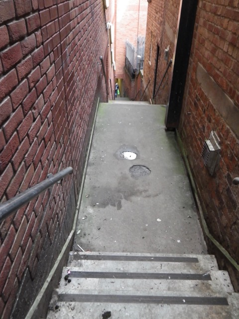
These steps look very precarious.

Next up was The Quarry and the entrance to Wonderland…

AKA The Dingle.

St Chad’s Church

Entrance to Wonderland/the Dingle. As you can imagine, my expectations were low.

First glimpses of this faery tale world before the bla bla bla.

Looking back to the entrance from which I came.

“This is the Dingle, created from a quarry, which produced building stone for the early town. Long abandoned, a pool had formed in the lowest part and was used for watering cattle; one old photo shows children skating here during a cold spell. The quarry was landscaped in 1879, with a path and shrubs around the lake and a more formal area of flower beds that are replanted seasonally.”

The Dingle is the last stop on my next tour, so here is more information from that guide: “Although the rest of the Quarry was laid out as a park with an avenue of lime trees by the Corporation in 1719, an early photograph shows the Dingle as a ‘wild’ area, with a natural-looking pool; Charles Darwin is said to have fished there for newts. … The fountain in the centre of the formal flower beds was given to the town in 1889 by the Independent Order of Oddfellows. The gardens are a Percy Thrower legacy … He was park superintendent from 1946 to 1974 and became known nationally as the TV gardener. The Dingle is the jewel in the crown of the Parks Department, … each year it is brought to perfection for the Flower Show in August. Trees in the Dingle include Maidenhair Tree, Sweet Gum, Ginko, Tulip Tree, Swamp Cyprus, and an enormous mature Beech.”

Back to the Victorian guide, “At the far end of the lake is the statue of Sabrina, Goddess of the River Severn, now reclining in her own grotto…. The Earl of Bradford presented her to the town in 1879.”

I had fun watching the ducks for a bit.

Interesting artwork in a tree.

What an amazing spot, like a miniature Buchart Gardens.

I reluctantly left The Dingle and found the cast iron bandstand that dates from 1879 and which in recent years has been revived every odd Sunday afternoon

Across the river is the Pengwern Boathouse, with its typical Victorian architectural style.

“The Boat Club was founded in 1871 when rowing was very popular and it had racing boats as well as a number of pleasure boats. It moved to these premises in 1881 and still flourishes, holding a popular regatta in May.”

Very near the stop where I took the boathouse pictures, I came across this stout post just before the Kingsland Bridge, which you can see in blue in this picture. “This is an old ferry post, the windlass can be seen set back above some steps on the other bank. There were several of these pedestrian ferries in central Shrewsbury, which saved people a long walk to either the Welsh or English Bridge. This one was superseded by the Kingsland Bridge in 1882, which gave access to the fine Victorian suburb of Kingsland and the new Shrewsbury School. … The bridge, known locally as The Penny Bridge, as it charges tolls, has always been privately owned and operated. The ferry remained for some years and the boys from Shrewsbury School used it to avoid paying the toll to cross the river.

I now had a very long stroll ahead along the water, so I took the time to enjoy the surroundings.

Back of a structure we will see from the front…

Kingsland Bridge.

Looking to the centre of town. Notice the cathedral. That’s my second to next stop!

The Greyfriars pedestrian bridge, where I turned left to begin a surprisingly gentle climb back to town.

But first, this obelisk, “in memory of Dr W J Clement, a skilled and innovative surgeon, philanthropist, a long-serving local councillor, mayor, and for a while M.P. for Shrewsbury. He demanded reform of rotten boroughs, thus antagonising the Tories who dominated the Corporation. In return, they refused him a post at the hospital. … The memorial was erected in 1873 and was originally outside the railway station, but has been moved several times.”

Off I want to the cathedral, marvelling that I was all the way down there just moments before.

“The steep-gabled, neo-Gothic church is, in fact, the Roman Catholic Cathedral. It was started in 1853, only 20 years after the Catholic Emancipation Act and soon after the restoration of the Catholic hierarchy in Britain. … The limitations of the site led to some alterations to the original plan; the tall spire was replaced by a bell-cote and the chancel is very shallow.”

Looking back along Town Walls. If you keep going, you can turn left to take Wyle Cop to go back to the centre.

Looking ahead. I found it interesting how the sidewalk was so far up the road as to need a railing.

This is a water pump. There are several in Shrewsbury and they are all listed by English heritage. “They day from 1870 and the inscription encourages the careful use of water; the basin at the base catches any waste, which can be used for animals.”

Door to the watchtower. There is no information about this building on this tour, just its name.

The watchtower.

Looking towards my next two stops.

First is the girls’ high school.

Can you read the sign?

The high school was built in 1897-98. “This independent school is part of the Girls’ Day School Trust set up in 1864 following a National Enquiry, which concluded that there was ‘a general deficiency’ in the provision of secondary education for girls. The aim was to provide a high standard of academic, moral, and religious education for all social classes.”

Next is the magnificent neo-Gothic building we saw the back of down by the river, the former Eye, Ear, and Throat Hospital, opened in 1881, and now converted into flats.” I know where I’m moving to… 😀

“Its construction was a great example of Victorian philanthropy, ‘upwards of £12,,000 being raised largely through public subscriptions. … The cantilevered operating theatre windows on the second floor were originally glazed with single sheets of plate glass to provide maximum northern light for operations.”

I then turned up Swan Hill to get to my last destination.

This wasn’t on the tour, but was pretty.

The final stop is the Italianate former Police Station/Weights and Measures Office, built in 1893 “to house two important new services that were to be carried out by the local authority. The provision of a police service was made compulsory in 1856, though Shrewsbury was ahead of the game, having appointed 13 constables 20 years earlier.”

“In relation to the weights and measures, there were many attempts throughout the Victorian period to standardise weights and improve the standards of retail transactions. Between 1878 and 1893, new mechanisms for inspection and enforcement were established.

Thus ended the delightful Victorian tour. I think this was my favourite!

Heading home up Pride Hill, I was shocked to find that the McDonald’s had closed permanently. Am I glad I was able to visit its basement before that happened! I hope that Shrewsbury will not permanently lose that important landmark.

Sushi at Umai and then the Self-Guided Tudor Town of Shrewsbury Tour

I had to finish up a super tedious file today with a very late deadline, so I decided to do half the work this morning, go and have some fun, and then come home to finish. I wanted to be gone all afternoon to have lunch and do two walking tours, so that would mean an outing of 3.5 to 4 hours, the longest I’ve been away from Puppy. Needless to say, I planned my outing with military precision!

I worked steadily to noon with a mid-morning break to give Puppy a walk. Noonish, I gave her lunch, then had a play session to wear her out. Once she’d had a bowel movement and pee, she was very happy to go into her crate for a nap. Knowing that she’d had plenty of exercise and was being left with a fully tummy and empty bladder, I felt comfortable leaving her. She didn’t even whine as I prepared to head out, which was gratifying.

So first stop was Umai Japanese restaurant. I haven’t had a proper sushi meal since Málaga (and even that was stretching it a bit) and was very overdue, especially since I’ve been having the truly mediocre Tesco stuff to soothe the itch. We’ve been by the restaurant a few times as it’s in the Cross Keys Passage. I doubt I’ll have time to come here for dinner before I leave, but I realised this afternoon that I really should go see Shrewsbury after dark and whether these shuts are as spooky then as I think they would be!

I thought the restaurant was just this tiny bit on the shut, but, nope. There’s a large dining room at the rear towards Princess Street.

I went with the £12.50 mixed sushi special as that would give me the most bang for my buck. Such specials tend to be at the chef’s discretion, but I really wanted octopus. So I asked if a couple of my five nigiri could be octopus. The server said she could ask, but normally there are no substitutions for the lunch special and octopus is never included. So I was delighted when this beautiful plate came very quickly!

Everything was so fresh and this was the first time I’ve been able to describe the maguro (tuna — dark pink) as “buttery.” Whenever I’ve read that description of the fish, I’ve thought people were off their rockers or there was something wrong with my tastebuds! My only quibble is small, that I got three pieces of salmon sashimi plus a salmon nigiri and salmon isn’t my favourite (I’d rather maguro, but I know that’s much more expensive!). The maki (roll) had crabstick in it, so it wasn’t special, but I loved the masago (the orange stuff round it) as I haven’t had it in a while. The octopus was absolutely perfect and exactly what I hoped it would be.

I was enjoying my last piece of it when the server went to take away my plate and I had to quickly swallow and tell her that I wasn’t done as I still had my ginger left! I always save it for the end so that I don’t walk out with a fishy taste in my mouth. That’s one thing I haven’t missed about Canada, the US, and the UK, how I feel rushed to get out of a restaurant. Anyway, my lunch was YUM and very filling. I couldn’t believe the quality and quantity for the price.

I then walked a short distance to the Shrewsbury Museum, where I bought two more self-guided tour pamphlets, a second one for today and one to save for perhaps Monday. Then, it was time to start my tour of the Tudor Town of Shrewsbury. This was the least value tour as it is very light on stops. It said to plan for two hours, but I think I got it done in 30 minutes!

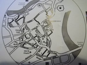
Here’s their map of the tour (click to embiggen to legible size):

The introduction to the tour from the brochure: “Following a disastrous trade depression in the previous century, Shrewsbury’s fortunes revived in the later Tudor period. The population grew and merchants thrived, especially drapers, the middle-men dealing in woollen cloth. It was a period of great re-building. Shrewsbury is one of the best-preserved Tudor towns in England, with many listed 16th century buildings. In this walk, we will draw your attention to just a few, but hope that you enjoy the Tudor townscapes. All of this is, of course, against a background of medieval buildings, many of which still remain — not just the parish churches, but also many of the commercial buildings.”

So chronologically speaking, this tour comes after the medieval one. The first stop is the Tudor exhibit in the museum, where we’ve already been.

Next up, I got all my questions, and then some, answered about the Old Market Hall I have passed a kazillion times. It’s right in front of the museum/music hall.

The Old Market Hall “was built in 1596 by the powerful Guild of Drapers who chose to use stone, which is slightly unusual since most market halls of this era were timber-framed. Tuscan columns support the first floor, where there was a chamber for Welsh cloth dealers and Shrewsbury drapers to meet and negotiate prices.

“The covered area beneath was for the sale of corn. In the far left corner, note the tally stone used to record or document quantities or prices.

“The Square had been the market place since the 13th century, long before the Market Hall was built, and milk and vegetables continued to be sold here until 1868 when the general market was built.”

There are many decorations around the hall.

“On the west side, the large coat of arms with the Tudor dragon and the English lion belongs to Elizabeth I, who was reigning when the building was erected.”

The hall was restored in 2001-2 and is now a café and cinema. You can go upstairs to see the roof.

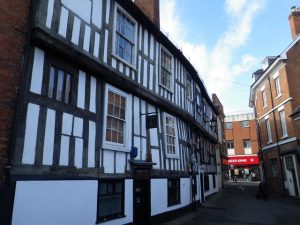
Directly across from the Old Market Hall, on High Street, is “Owen’s Mansion, built in 1592. Richard Owen was a prominent woollen cloth merchant and this was his prestigious house, in the centre of the commercial area.

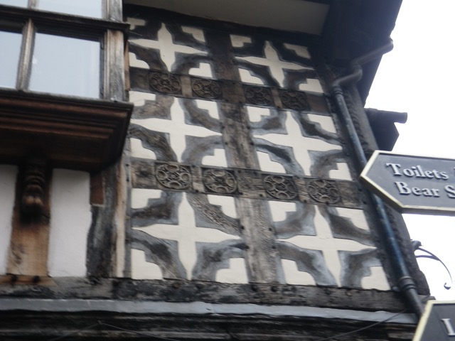
“This is a good place to note the curved braces, a shallow S, used to strengthen the frame and the quatrefoils, 4-pointed designs. These and the carving of timbers to form cable mouldings are typical of the Shrewsbury school of carpentry. … the finials depict a warrior and his lady.”

Across the street is Ireland’s Mansion. “This was described by Sir Nikolaus Pevner, the 20th century writer on art and architecture, as the ‘Grandest timber framed house in Shrewsbury.’ This massive building, tall, broad, and symmetrical, was constructed in 1575 for commercial purposes by Robert Ireland, another wealthy wool merchant. It was three different houses, with shops on the ground floor, offices above, and accommodation in the attics. Locals are said to have called it ‘Ireland’s Folly’ because of its immense size. It has four projecting full height bays and four large gabled dormers.”

“This is a good place to see cable carving at close quarters.”

Next stop was my favourite building on Pride Hill.

“Space on major commercial streets was at a premium and often shops were very narrow, but the owners made up for it by building several storeys and also by adding jetties jutting out into the street at both first and second floor levels. This very narrow timber-framed house is Thornton’s. “This probably was a medieval shop with a single chamber above.

“The decoration on this building is interesting: under the first floor window is a design of cusped concave lozenges and the bargeboards are original, with damask work decoration. For some reason, the gable has been placed asymmetrically.”

Then, I was off to the library. By this point, one of the reasons the tours were taking less time is that I knew my way around!

The library used to the Grammar School, which “was founded in the reign of Edward VI in 1552, partly financed with money gained from the dissolution of the collegiate churches of St Chad and St Mary. The building is an amalgam of dates from 1450 to 1630 (main façade).”

I went into the library’s courtyard.

Across from the library is a big yellow house I’ve been curious about.

This is “a fine example of a late Tudor house.” It was moved from its original location around 1700.

I then headed to Windsor Place to see a long, curved building. It “is a side wing of John Perche’s house built in 1581. Its front is hidden behind the shops on Castle Street. This more natural brown and cream was the norm in Tudor times rather than the Victorian ‘renovations’ in black and white. … John Perche was another rich wool merchant and he served as bailiff four times.”

I then headed around the back of St Mary’s Church to find my next location almost at the corner of St Mary’ Street.

It is Drapers’ Hall, now a restaurant. “The trade in wool and cloth manufacture brought great prosperity to Shrewsbury in Tudor times and the Guild of Cloth Merchants or Drapers dominated other tradesmen like shearmen (finishers) and the mercers (retailers). The built this hall as a meeting place in 1577-78and added a second story in 1580. … The Drapers were a reliouss as well as a trade guild — The Brethren of the Holy Trinity.”

On my way to my next  destination, I saw something that drives me nuts and which I admire Amsterdam for not doing, changing the name of a long street partway.

My next stop was the original site of the Bradford House we saw above.

Heading back to The Square, I learned some interesting things about this Costa at the corner of Grope Lane. It was once the Cross Keys Inn. “It was restored in about 1990 and the beams were stripped of their black Victorian paint to reveal the original brown colour. The first floor [upstairs in the UK] is much the same as it was, but the restorers added a number of contemporary allusions in the carvings on the replacement bargeboards.”

I can’t see it, but one of those tiny figures is supposed to be Margaret Thatcher.

I went back through Gullet Passage to get to my next destination.

Right at the end of this passage is an unnumbered stop. This building is timbered on one side, but has a brick front, a good example of a Tudor building that was modernized in the 18th century.

The last stop is another place we’ve been. This is where I thought I would have done well to read the pamphlets ahead of time to save myself steps, but, hey, the exercise is good! Anyway, we’re back at Rowley’s House. “Today it stands in solitary splendour, surrounded by car parks, but originally it stood amongst a jumble of yards and passages, which may account for the unusual shape and positioning of the building. It was built in about 1590 and, since it has no chimneys, it is believed to have been business premises. It probably was used by William Rowley, a draper, brewer, and malster, as a warehouse. A little later, early in the 17th century, Rowley built himself a fine brick mansion attached to the timber-framed building. This is believed to be the first brick building in Shrewsbury.”

I was underwhelmed by the Tudor tour, but grateful to have that knowledge about some of the buildings I’ve noticed many times. But I found myself wondering if the next tour would be worth my time since I felt like I was just basically walking in circles around Shrewsbury’s core repeatedly (to the point that a couple of panhandlers felt a need to ask me if I was lost and needed help!). But I’d paid for the guide, so I figured I might as well go ahead.

Little did I know, I was minutes away from falling down the rabbit hole into Wonderland.

To be continued…

Off to Tesco

I’m on the tail end of another large burst of work. I’ll have made for one of my clients in the last week what I normally invoice them for in three weeks! So I’ve only had time for work and puppy stuff the last few days. But today, I really had to get some groceries. I debated doing one final order with Tesco delivery since there are no full size grocery stores I can walk to and it’s a mile to a Tesco Express, but decided that I didn’t want to end up like in Hebden with too much food I need to use up and just get my groceries locally. Since I’m hoping to get to town tomorrow to do another self-guided walk (no time for that today), I didn’t particularly want to walk in to get my groceries. So I did some research and found another Tesco Express in the opposite direction and still only a mile from me.

So off I went around 10:30 this morning. Part of my route was through a park I go to daily with Puppy. She’s not a very good walker yet, so I didn’t want to take her all the way to the shop, plus I didn’t want to have to leave her outside. So she stayed home.

Considering the poor road signage for cars, there is decent pedestrian signage on footpaths. This is the first one I saw coming into the park. My destination is on the side you can’t see very well.

This is a park straight out of my childhood. It has a proper playground.

There’s big wide open field for playing with your dog or kicking a ball.

I used to love biking on tracks like these when I was a kid! You can also see a basketball court where some local girls like to rehearse their cheerleading routines.

I went under this railroad bridge.

I walked below the Shrewsbury Flaxmill, which is undergoing a major regeneration.

It’s a very interesting building. I can imagine those bits projecting out as flats with wonderful views of the park, not that that’s what they’re doing with them.

I came around the front and was impressed by all the scaffolding.

There’s an art installation in front of the building site to keep people from having to look at the grey walls for two years. So there are a bunch of paintings, like this “Monet.”

Unfortunately, the paintings are all on chip board and deteriorating quickly. Here’s another one that’s aging well, though:

One side of the street in this Shrewsbury suburb had buildings that made me think of apartment buildings I’d find back home, except maybe for the bay windows.

But the other side was definitely “English.”

OH?

It’s a “gold bead,” but not the kind of bead I was expecting.

As expected, the Tesco Express was small, but adequate except for lacking in unsweetened almond milk and having slightly higher prices than online. I was able to put together a decent shop for £20 and am pretty sure that I’ll only need to do a slight top up at the shop around the corner from the house as I only have a week to ten days left here (depending on if I take the owner up on her offer to stay a few days to go explore locally).

I came in and spent some time exhausting Puppy so I could then get back to work. Thankfully, I learned very quickly in my stay here that when she’s in one her manic moods, I just need to give her my undivided attention for 10 to 20 minutes and wear her out with some ball throwing before she’ll flop down for a two-hour nap and let me work. I was really concerned the first couple of days I was here that I wouldn’t be able to work with her being so insane sometimes and I’m glad that we’ve settled into a schedule that works perfectly for us both. I mean, by the time she’s done with her two-hour nap, I’m as ready for a break as she is for playtime! Minding Puppy has been exhausting, but so rewarding and I know I’ve done a very good job of it.

Back to work I go… I should be able to go have some fun tomorrow as long as the weather holds. If I do, there will definitely be sushi. 🙂

A Self-Guided Stroll Around Shrewsbury’s Shuts

I woke up to the calm after Storm Doris (or Doris Day, as many people called it!). It wasn’t that bad as far inland and south as I am, but it was loud and wet. Puppy needed a lot of coaxing to go do her business!

I had no work in the queue, so I thought of doing another self-guided walk. But, of course, I woke up to a large, difficult job available to me if I wanted it. I’ve been having trouble getting work with this client during the week since I’ve been in Europe because of the time that work is assigned, but if there’s anything for the weekend, I tend to get it as I appear to be the only one who regularly works at that time. So the client assumed I’d want it and gave me both a bonus and an extension as an incentive. So of course I accepted it and thanks to the extension, I could still take today off. I’ve been sleeping really poorly the last few days and just had my first decent night, so I should be raring to go on the job tomorrow.

I did all the Puppy stuff and put her away for a nap around 9:30, then headed out. The morning was bright, but cold. I passed the perfect car for me along the way…

Coming into downtown, I was more than a little peckish since I’d had a super light breakfast. I decided to pop into Greggs for a coffee to warm my hands and a sausage roll as a second breakfast. Think of Greggs as being about as close to Tim Hortons or Dunkin’ Donuts as one can get in the UK. They have sandwiches, soups, baked goods, and reasonably priced coffee. I was disappointed that the combo would be more than it was in Manchester, according to the menu, but, no, it was still £2. It’s almost not worth getting a sausage roll if you get a coffee!

I munched my treat as I headed to the Music Hall/Shrewsbury Museum. Outside of it, I spotted an exhibit I either missed the other day or which is new. It’s a bunch of photographs from all over the world showing the many facets of humanity.

Some of my favourites included this one from a Soviet prison, in 1988…

…this hilarious scene from New York City…

…a sad-looking Canadian couple…

…a Tanzanian family…

…and Japanese folks enjoying the artificial beach in Ocean Dome, Miyazaki.

It was then time to start the tour. It covered most of downtown in a very logical, but twisty sort of manner and there’s no way to make a Google Map that would make sense of the tour. Here’s the very detailed map provided in the brochure. If you open it in another tab, it does so to full, legible size. I will number each of the stops so you can follow along if you want.

So today’s self-guided stroll was about Shrewsbury’s shuts. “‘The Shuts of Shrewsbury are a notable feature of the topography of the town.’ So wrote L.C. Lloyd in 1937. For those unfamiliar with the word, ‘shuts,’ they are called snickets, ginnels, chares, alleyways, entries, wynds, weinds, wiends, twitchells, opes, and twittons in other towns. In other words, they are narrow passages connecting one street to another. True shuts must be open to the public, used mainly on food, and should not be culs-de-sac. Other desirable qualifications are that they are ancient and between walls, with steps, archway(s), and a corner or two. … Many of the shuts have disappeared and most of the survivors have exchanged their picturesque (or scurrilous) ancient names for something more genteel.”

Let me tell you, the £1 price for this guide felt like a bargain! I was curious about the various passageways I’d seen through town, but had no idea if they were open to the public or not. I was off on a wonderful adventure!

My first stop was Gullet Passage (1). “‘Gullet’ means a water channel and, in fact, this shut follows the course of a former stream that was drained from a peat bog. This was filled in to make a new market place, which eventually became The Square.”

Phoenix Place/Passage (2) was unmarked. I was grateful that the brochure had pictures of all the entrances so it was easy to spot them. Whomever made these brochures should be commended.

“As this shut widens, note the remnants of doorways and fire-places in the brickwork. These are the remains of the 19 houses recorded here in the 1851 census, a warren of unhealthy dwellings in a crime-ridden area.”

“From this wide section the shut narrows again to dive under timber-framed buildings.”

The entrance on this side is well marked.

I passed the King’s Head Inn, which dates back to 1404.

Right after the inn is King’s Head Passage (3).

“As the shut leaves the inn, it curves round, as did all the shuts in this low part of town, and runs toward the river. In times of flood, water collects at its lowest point, where the town ditch was cut across it in medieval times.”

Looking back.

Emerging into blessed sunshine and blue sky.

I ended up on Smithfield Road and my attention was drawn to a plaque at the corner of Mardol, which has information about the Welsh Bridge.

The original bridge is gone, of course, but here stood one of Shrewsbury’s oldest bridges. It was built of stone, likely shortly after the Norman Conquest of 1066. It was then known as St. George’s Bridge. “Legend has it that in 1485, Thomas Mytton closed the bridge to Henry Tudor (later Henry VII), who was on his way to fight Richard III at Bosworth. Mytton declared that Tudor could only enter Shrewsbury ‘over his lifeless body.’ Forced to compromise, Mytton lay down and Tudor entered the town by stepping over him.”

Floods rendered the bridge unsafe in 1672. Some repairs were carried, but in 1795, St. George’s Bridge was replaced by the current Welsh Bridge.

“St. George’s Bridge provided the Welsh with important access to the English wool market, a trade that made Shrewsbury very wealthy.”

The other side of the plaque has information about Mardol. “Like much of Shrewsbury, Mardol has a hidden history. Behind its brick façades are complete timber-framed medieval buildings, traces of Saxon stonework, and Shrewsbury’s ancient ditch and wall defences. In Saxon times (900AD), Mardol was home to tradesmen who gained access to the river via long curving gardens. … By the 15th century, Mardol was home to wealthy merchants living in fine, timber-framed houses. Many of these were extended and brick faced in later centuries. … By the 17th century, Mardol had become the town’s red light district, providing drinking and whoring for the river boatmen and their crews. Today, it’s a thriving commercial street in Shrewsbury’s historic centre.”

Carnarvon Lane (4) was my next stop. You can see the entrance in the picture above, the rounded arch nearest the car.

“Ludovick Carnarvon lived here in 1460.”

I passed a lot of these tiles on my walk, but could not find anything about them.

“Rowley’s Mansion, one of the earliest brick houses in Shrewsbury, built by a wealthy draper and brewer in 1616-1618.”

Darwin’s Gate sculpture.

After a few turns, I came to Drayton’s Passage (5).

These dog heads “represent the Talbot breed, used for hunting in the 18th century, and provide a reminder that this was once The Talbot, a bustling and competitive coach inn at that time.”

This brought me back to the Music Hall, but I was only getting started!

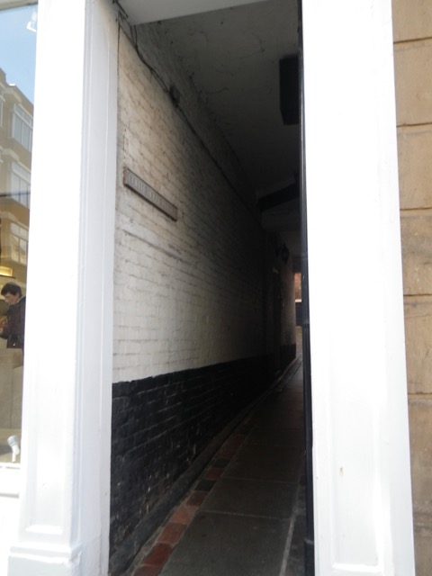
Next to the Music Hall was the Coffee House Passage (6).

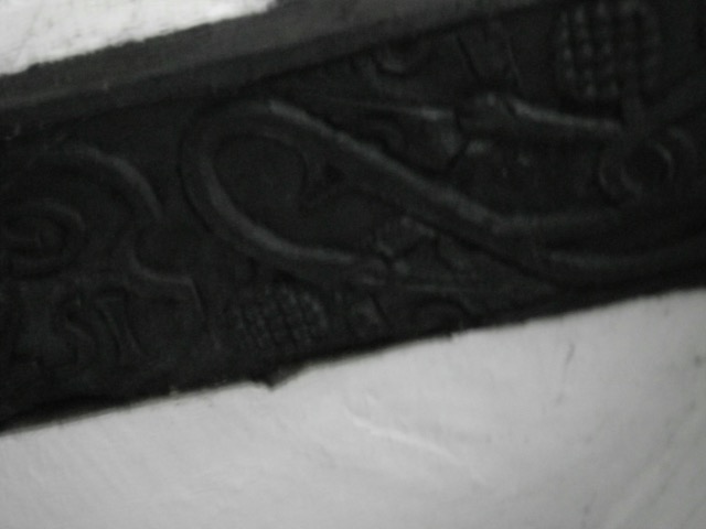
There is an intricately carved beam overhead. Is that a pineapple?

I love how the doorframe compensates for the crooked building.

More tiles. I looked up and didn’t see much…

I emerged to this pretty sight:

The tour then took me across Old St. Chad’s Churchyard. “The church was founded by King Offa, and is mentioned in the Domesday Book.”

Once again, the pamphlet directed me to an informational plaque I would have otherwise missed.

“The Church where Shrewsbury began? Many believe that here, on one of the two hilltops in the loop of the RiverServern, stood Pengwern, the court of the Princes of Powys (7th century AD). We know that by the reign of Offa, King of Mercia (757-96), there was a monastic college on this site. In 1148, it was replaced by a much larger church, which extended from Belmont to College Hill. … The building in front of you is known as ‘Lady Chapel.’ It is the only standing remains of the church, after it collapsed sensationally in 1788. Four years later, new St. Chad’s church was built near the quarry.”

This plaque had a wonderful timeline of key moments in Shrewsbury history. Here are some highlights:

901: First written reference to Shrewsbury as ‘Scrobbesbyrig.’

1068: Shrewsbury Castled built by Norman invaders.

1148: Found of Old St. Chad’s Church.

1216: Henry III orders the construction of town walls.

1349: Black Death kills half of European population.

1403: Battle of Shrewsbury.

1645: Capture of Shrewsbury by the Parliamentarians.

1788: Collapse of Old St. Chad’s Church.

1809: Birth of Charles Darwin in Shrewsbury.

1918: Wildfred Owen dies in WWI.

Wilfred Owen? A poet best remembered, by me at least, for his poem “Dulce et Decorum est.” I actually used to know it by heart.

I then noticed this plaque by a tree and it made me tear up. “In memory of Nigel Johnson, who lost his life whilst carrying out his duties on behalf of the people of Shrewsbury. A tree for a tree man.”

I then had to turn onto Belmont Bank, a part of which I walked on the medieval tour. In 1610, it was Back Lane, a name that was in use until the 1950s.

Next up was Barracks Passage (7), which we’ve been to before.

This passage was called Elisha’s Shut in 1725. “The long range of timbered buildings on the right contains timbers felled in 1426.”

This projecting window might have been for a tallyman to log the carts in and out of the passage.

A very short distance away is Compasses Passage (8), named for the Compasses Inn that stood on the site in 1880. “An old tale tells of a bull on its way to market straying from Wyle Cop and getting stuck in this narrow shut.”

You emerge on Belmont Bank. You can see Barracks Passage up the hill (the arched doorway before the red door).

On the way to my next stop, I passed a violin maker. Vicki, have they got a violin for you! 🙂

This private shut on Wyle Cop is not a numbered item on the list. It’s just big enough for a packhorse to enter the yard.

“The Lion [was] a notable competitor of The Talbot for the coaching trade in the 18th century.” Just across from it up and up a bit around the bend was my next turn, Dogpole.

The name of this shop caught my eye as it sounds familiar.

Does Wysteria Lane mean anything to any of you?

The unnamed shut in front of Dogpole House (9) was my next stop.

It brought me back to St. Alkmund’s Square, where we’ve been a few times.

I liked that this stroll brought me back to places I’d been from a different direction, offering me a chance to see them with fresh eyes.

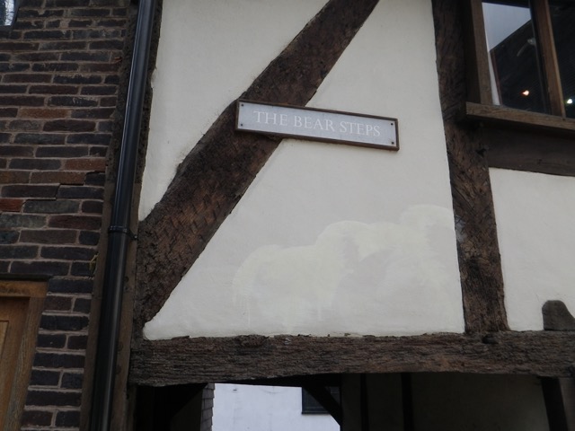
I went back down the Bear Steps (10) and then turned right to come right back up to the edge of St. Alkmund’s Square so I could turn onto Butcher Row.

“There were 15 butchers’ shops here in 1828, and Abbot’s House still retains some of its meat-hooks and ancient shop fronts.”

Pride Hill, the pedestrian street, is at the end of Butcher Row. I turned right and went just past the Darwin Shopping Centre to a shut called 70 steps (11). “This is the last remaining shut of the four that used to link Pride Hill to the meadows at the bottom of the slope, beyond the town wall. When the shopping centre was built, the shut was incorporated, providing a long, dark, and uninviting descent, which we do not recommend.”

I just peered in, as they instructed, and continued on Castle Street (Pride Hill becoming it in the direction of the train station) and found, thanks to their picture, Castle Court (12). “Here is an inviting cluster of houses and flats, those on the left converted from a chapel and those on the right once part of the old County Gaol and House of Correction.”

For this one, I had to turn back and go the way I came, to Castle Street, and continue along to School Gardens (unnumbered), “once part of Shrewsbury School,” which Charles Darwin attended. Yes, another scaffold. There are a lot of construction works going on in Shrewsbury. Must be all the old buildings keeping everyone employed.

This courtyard was part of the old goal and was “the quadrangle used by prisoners for exercise.”

I continued along to emerge at the Darwin statue in front of the library and archives.

I then circled back around up Castle Street (towards Pride Hill) and found St. Mary’s Shut (13). “This has the longest covered section of all the shuts in Shrewsbury and is very narrow and dark.”

The brochure told me not to miss the second part of it, across a carpark, but I was disappointed that there was scaffolding blocking it. Thankfully, I was able to access it from the other side.

This part of St. Mary’s Shut “is probably the narrowest in England with a minimum width of 56cm. Old maps show the shut closed in by buildings throughout its length.”

This brought me to St. Mary’s Place. I circled around the back side of St. Mary’s Church.

St. Mary’s Court is #14, but there wasn’t really anything to photograph.

Here I am emerging from it onto St. Mary’s Street, with Church Street directly opposite, which I took.

This brought me back to St. Alkmund’s, where I followed the path (15) to the La Lanterna restaurant, where I had a nice lunch the other day. Here’s its entrance.

I went down the stairs and turned right on Wyle Cop (Barracks Passage, etc. is to the left). Next up was another place we’ve been before, Golden Cross Passage (16). Let me tell you, I was seriously tempted by that affordable sushi, but I’d been out for a few hours and it was getting close to Puppy’s lunch time.

Emerging from Golden Cross, I turned right on Princess and then right again into Peacock Passage (17).

Of note in this shut is that you can see the spire of St. Alkmund’s Church. The effect was rather impressive.

At the end, you cross the High Street (difficult unless a cute delivery guy stops to let you cross) to get to Bank Passage (18).

It used to have more steps.

More tiles.

You emerge on Fish Street below St. Alkmund’s Church.

Looking back down Bank Passage.

Looking down Fish Street.

Do you know where you are? The Bear Steps are to the right after this building and Grope Lane (19) is to the left.

Bear Steps yet again.

And back to Grope Lane, which was the first stop on the medieval tour.

I emerged on High Street. Market Place and the Music Hall are to the left. I continued ahead to Pride Hill.

I passed a bookstore along the way. I need this book.

I turned right on Pride Hill and popped in at Tesco’s for a few things, including some mediocre sushi for lunch. I haven’t had proper sushi yet in England, so that’s something I definitely intend to do before I leave. The place I passed today is apparently really good and has very reasonably priced lunch specials.

I hope you enjoyed this tour of Shrewsbury’s shuts as much as I did! I have one more tour pamphlet left, but I may go buy more since I have almost two weeks left here. Let’s hope the weather holds up!

Shrewsbury Museum and Medieval Centre Self-Guided Walking Tour

I can’t believe I haven’t been out for almost a full week! Well, I have been going for daily walks with Puppy around the neighbourhood, but that’s been it. I had an unexpected burst of work that kept me very busy indeed! It wasn’t an unmanageable amount, but between that and Puppy and house duties, there wasn’t much time left except for an hour or two of Netflix in the evenings. I had the day off today, so I was able to head out to the Shrewsbury Museum, the only thing left on my to-do list for Shrewsbury proper.

Puppy and I had lunch, then I took her for a walk before settling her in her crate for her afternoon nap that meant that she’d barely know I was gone.

Spring is springing in my part of England. These are from the garden here.

I headed downtown by way of the route to the train station. Not sure if it’s a short cut, but it lets me do a loop. I like this row of cottages along a walk and bike path. They all have different coloured doors.

The museum is off High Street. It’s so strange to see here a bank I use in Mexico.

Market Square.

The Shrewsbury Museum & Art Gallery is in the old Music Hall.

Admission to the museum is £4.50 and well worth it! This museum is a trove of treasures! There is absolutely no way I can do justice to it as that would involve recounting 2,000 years worth of British history, for which I have an unfair advantage over most of you. So I’ll just share a few things that caught my eye.

You start in a very thorough exhibit about Roman Shrewsbury, starting in the Late Bronze Age and into the Iron Age to set some context. There was an exhibit inside a miniature “roundhouse” that explained how those people lived.

The ceiling:

Here’s what a roundhouse would have looked like.

The roof:

I learned in this exhibit that there are 70 hill forts in Shropshire, more than anywhere else in Britain, and that they had purposes beyond defence.

The Roman invasion was “a terrifying and shocking experience for the local people.” For some, life went on as before. Others took advantage of the situation and provided the soldiers with goods and services. New materials and technologies appeared. Think of what would happen in North America some four or five centuries later.

An interesting fact I learned is that the Romans introduced tombstones to Britain. Here are some Roman tombstones:

Here’s what a farming settlement might have looked like at the time. This was not a primitive society.

I saw some wonderful mosaics that reminded me of those I saw in Bulgaria.

One of the innovations the Romans brought was writing. “There is no evidence of the written word in Shropshire before the Romans arrived.” The soldiers who conquered the region would have been literate.

Wealthy Romans had all the comforts most of the developed world enjoys today, included glazed windows, painted walls, central heating, and running water. The underfloor heating was particularly ingenious. “Hot air from a furnace circulated under the floors and was sent up pipes built within the thickness of the wall and roof, something like a modern central heating radiator.”

Of course, the Roman period moved into the so-called Dark or Middle Ages. By 650 AD, the nearby Roman city of Wroxeter was abandoned. “What is certain is that bit by bit, the grand buildings of this once-fine city rotted and collapsed.” I hope to get a chance to visit the ruins of Wroxeter before leaving here.

Here is the most incredible artifact I saw today, a silver mirror that would have been held by a slave. It is “the finest Roman mirror found in Britain”!

The Shrewsbury Hoard:

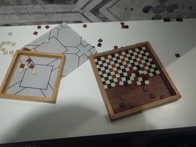
I had fun playing with mosaic tiles.

Just a tiny bit of some of the Roman artifacts I saw. These are all jewellery or pieces used to tie togas and tunics.

I headed upstairs and found this signage rather confusing!

Into the medieval section.

I recognised this straight away, having spent quite some time poring over it when I was in university! It is the Great Domesday Book of 1086, a great survey undertaken by Willian the Conqueror after the Norman Conquest of 1066 to learn who owned what and its worth, all for taxation purposes. This segment is about Shrewsbury, whose townsfolk felt they were being overtaxed.

The medieval section has a timber frame ceiling.

Shrewsbury as it would have been in the 16th century.

This shows what the English Bridge would have looked like during the Middle Ages. It originally had two sections, with an island in the middle.

This was a fun game. There are magnets that you need to place in the correct spots to create a medieval town. I got to work!

Ta-dah.

It’s a real family!

Medieval tiles.

This did not go well.

I actually have real quill pens that I purchased when I went to Washington DC in 1997.

This screen by Shrewsbury Abbey played an episode of Cadfael.

There he is.

Medieval armour.

Next, I went into the exhibit about Tudor Shrewsbury, starting around the end of the 16th century. By this point the town’s economy was stagnant, the population was dropping, and buildings were in disrepair. The reformation of the church had left the abbey and friary buildings in ruins. But by the 1560s, there was a revival of the woollen cloth trade and the town began to prosper once more.

A bed owned by the Corbet family of the area.

The embroidery was exquisite and all done by volunteers according to traditional patterns.

Looking back to the medieval section. There were so many children running around that I wasn’t able to spend as much time as I would have liked. 🙁

Daniel Defoe, in his A Tour through the whole of the island of Great Britain, 1724-26, described Shrewsbury as “A town of mirth and gallantry.”

Then came a hodgepodge of exhibits where I learned a very surprising fact that I’m shocked I didn’t know: Shrewsbury is the birthplace of… Charles Darwin!

There was a very interesting bit about the natural history of the area and I got to hold a mammoth tooth!

I learned about the ceramics and porcelain trades here, made possible thanks to the good Shropshire clay.

Near the end of the regular exhibits, I saw a panel that said something I’d never been explicitly told, but knew implicitly, that “teenagers” are a very modern concept dating to the mid to late 20th century.

I also learned that the Victorians were mad about ferns and that led to some species becoming locally extinct!

“Trying to Find my Ancestors in a Cross Cultural Word,” is a portrait that “parodies passport photo-booth images and combines the artist’s own face and those of Victorian ethnic stereotypes.”

They combine to form this famous face. Amazing!

Finally, there was a special exhibit about British nursery rhymes.

I had never heard the “go to Spain” line of this classic nursery rhyme.

I love this!

There was another room upstairs, but I’m not sure what for. It did give me a great overview of the “miscellaneous room”and its ceiling:

And the exterior of the music hall.

There’s loads more to see at the Shrewsbury Museum, but that’s what I’ve got to share with y’all. Then, I was off to take a self-guided walking tour.

Back of Market Place (museum behind me).

The museum has a bunch of self-guided walking tour guides. I picked the top three that interested me the most. If I get through these, I’ll go back for more! They are really well done and detailed, so the £1 cost is very fair. I have maps at the bottom of the post to orient you once the walk recap is done.

The Medieval Centre brochure had this to say as an introduction: “Shrewsbury was an important town in medieval times. William the Conqueror put a strong baron, Roger de Montgomery, in charge of this lawless border region and the settlement was fortified as a strategic town to defend England against the Welsh. The Normans also reorganised the church and the importance of religion in daily life can be deduced from the remains of the Abbey, three friaries, and four parish churches in the town centre. Shrewsbury became an important market town and trade centre, attracting merchants who built substantial stone mansions in the 13th and 14th centuries and timber-framed buildings in the 15th century.”

The tour starts at the Music Hall, which incorporates Shrewsbury’s most intact 13th century stone house, Vaughan’s Mansion, owned by a leading fleece exporter.

From there, I walked back towards High Street, crossed it, and found myself in Grope Lane, which was referred to as long ago as 1324. It is one of the rare Grope Lanes that retained its name through the centuries. Its name came about for exactly the reason you think.

This is a good spot to see some of the old timber framing up close.

Grope Lane leads to Fish Street, from which you can climb the Bear Steps.

“The complex of buildings at the top form the core of medieval Shrewsbury. It was built and altered over many years and dendrochronology shows that the earliest timbers date from 1358.” So that answered a question, how they date the buildings.

This is the area where the medieval market would have been held.

I then headed to St. Mary’s Church, “the only great medieval church in Shrewsbury to have survived intact.” Its core dates to 1150.

I can relate (pun not intended) to this sign I passed on the way to my next stop.

What I’ve been calling the main pedestrian street is actually Pride Hill. In the Middle Ages it would have been lined with shops, just like today.

Next stop on my medieval Shrewsbury tour was the McDonald’s. Really.

Check out its basement! It would have been the cellar of a business on Pride Hill.

I circled back to the High Street, passed Grope Lane, and found myself at the Golden Cross Passage, which is typical of Shrewsbury’s shuts, or short cuts between two streets. The Golden Cross Pub has been dated to the late 15th century!

I emerged on the other side to take Milk Street and then turned on Wyle Cop to stop just after the Lion Hotel.

There, I could see two medieval timber-framed buildings, one of which was built in 1406.

The tour then took me through Barrack’s Passage.

These well-preserved buildings are 2 of the 32 surviving 15th century timber buildings in Shrewsbury.

From Barracks Passage, I descended Belmont Banks to get to the Town Wall.

Here’s a bit of the town wall.

There was no good vantage point, so it’s hard to show how high up the wall is. The wall was “terraced into the river bluff at the edge of the river flood plain. The whole wall was 3.2km long and was built between 1220 and 1250, on royal orders, following the successful attack on the town by Welsh forces. … The major part of the wall encircled the high ground and ran down to the river, where there were gatehouses on the two bridges. Much was destroyed in the 18th century and this is the best remaining section.”

I then retraced my steps and went down Beeches Lane to turn onto St. Julian’s Friars.

Instead of crossing this foot bridge, I went under it to the tow path.

These cottages are all that remain of the perimeter buildings of the Franciscan Friary founded in 1245.

I continued along the tow path to English Bridge.

Having been to Shrewsbury Abbey, the next stop, already, I didn’t go back since I’d been gone quite a while and needed to get home to Puppy. Instead, I continued to walk along the river.

These arches are part of the remains of a Dominican Friary.

It was then time to head back to the centre of town along St Mary’s Water Lane. It was a pretty steep climb.

The last stop of the tour is the castle. I’m undecided if I will go there because I’m not that interested in the military museum it houses.

“The castle was built within three or four years of the Norman Conquest [1066]. Its primary purpose was to dominate the town, to monitor and intimidate the population, and suppress rebellion. From here, the garrison could survey the whole town, including the approach through the neck of the meander, any movements on the river fords and hostile gatherings in the market place. Today, the inner bailey has stone curtain walls built in the 12th century on top of the original Norman ramparts. The crenulated parapets were originally medieval, though they have been repaired or replaced several times. The hall, with flanking circular towers, is mid-13th century.”

From this final stop, it was an easy one-mile walk home along the river.

Here’s a general overview of my afternoon:

And a more detailed map of some of the highlights of the walking tour.