Pecos National Historic Park

John pointed out to me yet another national monument/park just a short distance from Santa Fe, the Pecos National Historic Park. Yesterday promised to be, and was, a gorgeous day, so I decided to go check it out. I got a late start because I was working on the project from hell (most projects of that type would have taken me three hours and it took seven), so I only arrived around 12:45.

The website made it seem like there was a lot to do, with two trails and two tours, but they were still on their winter hours and their Civil War trail was closed. There was a tour at 1:30 of a ranch house owned by Academy Award winner Greer Garson, a benefactor of the park, but that didn’t interest me. Despite that, even if I had had to pay the $3 admission fee, I would have come out of there feeling that I got my money’s worth. If you like history and are interested in ruins, Pecos is a must-do for Santa Fe!

The drive there felt longer than it was because there was a bike marathon thingamabob along a good part of my route to I-25 and instead of being able to drive 50MPH, I had to drive 25MPH. But I eventually got there!

Made it!

Made it!

Look at what I found in the parking lot, a car with a license plate from ARGENTINA!

A license plate from *Argentina*!!!

A license plate from *Argentina*!!!

I’ve heard that Argentinian Spanish is very different from European and Mexican, but this was too interesting to ignore, so I went up to the couple and said in Spanish, “Wow, big journey! How long have you been traveling?”

This is Spanish speaking territory, so they weren’t shocked by the Spanish and replied, “Two years!”

We then had a bit of a chat about their trip. They are arriving in Alaska this summer. I gave them some suggestions (do not miss Dawson City!) and answered their questions about the Alaska Highway. We could understand each other just fine! And just as I was leaving some time later, they came to grab me to act as an interpreter because they were having trouble with a Ranger’s accent. I’m really starting to feel like I speak Spanish now that I’ve communicated with folks from four different Spanish speaking countries (Spain, Mexico, Chile, and Argentina) and been understood. So cool!

But enough about that, you want to hear about Pecos!

Pecos is one of the most important Native pueblos of the area, home to some 2,000 people.  Archeologist Kidder found here perfectly preserved layers of history that enabled him to sort out timelines, tribes, and categorize pottery with methods that are still used today. He considered Pecos the place that helped to make sense of the until then scattered and conflicted information about the peoples of the region and work out a plausible chronology.

A 16th century report of the pueblo describes it as the “greatest and best” of the Indian pueblos, and is, “most thickly settled.”

You learn all of this in the visitors’ centre little museum, which does a good job of setting you into the context of Pecos. Then, you head outside to see the ruins.

From the visitors’ centre, there is a trail (accessible) that takes you around the ruins of the pueblo all the way to the ruins of 17th century and 18th century churches built by the Spaniards determined to bring Christianity to these ignorant savages.

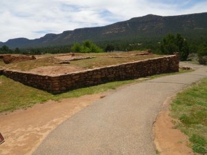
I was surprised by how much there was to see. The pueblo had been like a large fortress, made of 700 rooms, four to five stories high, around a central courtyard, with the upper stories linked by balconies and walkways. It must have been quite a sight!

The pueblo would have had a wall all around it.

The pueblo would have had a wall all around it.

IMGP1730

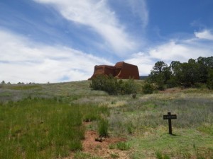
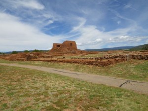
The church in the distance.

The church in the distance.

The trail is a bit of a treasure hunt if you are loaned the trail brochure, several sheets of laminated paper with tons more information than you find on the sparse placards scattered throughout the site. I had fun looking for all the numbered markers.

I was loaned this trail guide.

I was loaned this trail guide.

Snow in the distance.

Snow in the distance.

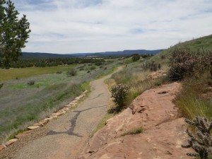
Wheelchair accessible path.

Wheelchair accessible path.

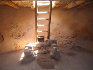
Kivas were circular holes in the ground accessible via ladders. The entrance led to a ceremonial chamber where much of daily living, including weaving, was done. There are two kivas on the tour that you can actually enter!

Entrance to a kiva.

Entrance to a kiva.

Hey, you can really go down!

Hey, you can really go down!

I can never resist stuff like this.

I can never resist stuff like this.

Surprisingly light down there.

Surprisingly light down there.

Ceiling.

Ceiling.

This hole represents the journey of the Pecos people to this world.

This hole represents the journey of the Pecos people to this world.

Masonry of the kiva walls.

Masonry of the kiva walls.

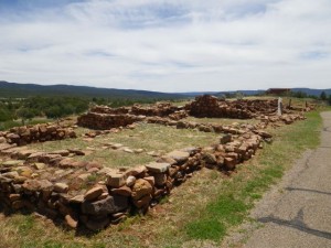
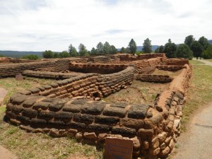
Foundations are all that remain of what were four or five story buildings.

Foundations are all that remain of what were four or five story buildings.

Kivas.

Kivas.

There was a trash heap here.

There was a trash heap here, a goldmine for archaeologists.

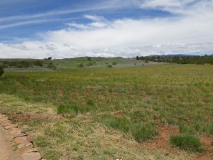
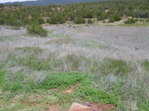
So much open country.

So much open country.

You could have seen all around from up here.

You could have seen all around from up here.

More snow in the distance.

More snow in the distance.

This sign made me laugh.

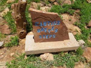
This sign made me laugh. See how uneven the word uneven is?

Up a few stairs for a view!

Up a few stairs for a view!

Looking from the top of the stairs across another kiva.

Looking from the top of the stairs across another kiva.

Contemporary descriptions make it sound like a medieval castle, both in its construction and occupation, with all manner of trades, such as weaving and pottery, being practiced, and there being music.

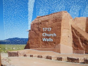
What the pueblo might have looked like.

What the pueblo might have looked like.

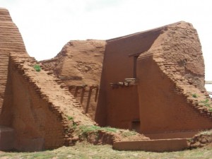
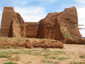
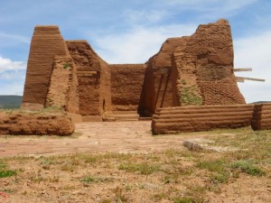
Then, you get to the churches. What we see are the foundations of the 1625 church and the ruins of the 1717 church walls. The first church was destroyed in a 1680 revolt by the Natives, but they didn’t keep their independence for long.

Approaching the church.

Approaching the church.

What remain are bits of the newer church.

What remain are bits of the newer church.

It would have been white washed.

It would have been white washed.

Foundation of the older church.

Foundation of the older church.

You can see a lot of details of the construction.

You can see a lot of details of the construction.

The grass is trying to reclaim it.

The grass is trying to reclaim it.

The Pecos leaders gave each pueblo a knotted rope. Each knot represented a day. When there were no more knots, it was time to attack the Spaniards.

The Pecos leaders gave each pueblo a knotted rope. Each knot represented a day. When there were no more knots, it was time to attack the Spaniards.

I was shocked that we could enter the ruin and walk around! This is where I spent most of my visit, admiring the architecture.
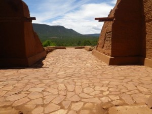
I couldn't believe I could go in!

I couldn’t believe I could go in!

More foundations of the old church.

More foundations of the old church.

Entering the newer church.

Entering the newer church.

Narrow passageway...

Narrow passageway…

...into a courtyard.

…into a courtyard.

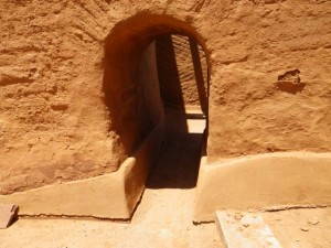
Another doorway to explore.

Another doorway to explore.

And another.

And another.

Look at the two angles of the masonry joining together.

Look at the two angles of the masonry joining together.

This buttress is perfectly preserved.

This buttress is perfectly preserved.

I like how the park uses these wooden fences to gently corral guests.

I like how the park uses these wooden fences to gently corral guests.

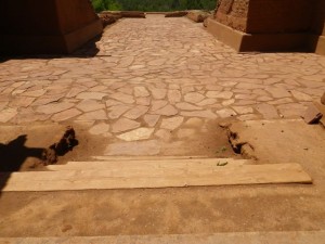
I should have asked if the flagstone is original or at least a replica of what would have been used.

I should have asked if the flagstone is original or at least a replica of what would have been used.

Also curious about the stairs.

Also curious about the stairs.

You can really see the detail of the masonry work here.

You can really see the detail of the masonry work here.

Vigas (wooden ceiling beams).

Vigas (wooden ceiling beams).

The construction is just like that of a medieval keep, with a flared base to distribute the weight of the building (and I thought my medieval history degree was never going to be useful in the real world!).

The construction is just like that of a medieval keep, with a flared base to distribute the weight of the building (and I thought my medieval history degree was never going to be useful in the real world!).

Two-toned masonry.

Two-toned masonry.

This drain is original! The holes in it are perfectly round!

This drain is original! The holes in it are perfectly round!

Oodles of foundations.

Oodles of foundations.

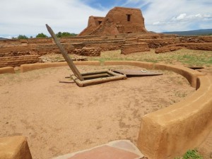
Another kiva.

Another kiva.

What is it with me and pokey places?

What is it with me and pokey places?

Oh, just like the other one.

Oh, just like the other one.

This would have been a turkey coop, with a cobblestone floor for easy cleaning.

This would have been a turkey coop, with a cobblestone floor for easy cleaning.

The directional signs made me laugh.

The directional signs made me laugh.

This would have been a 16th or 17th century residence or part of a farm.

This would have been a 16th or 17th century residence or part of a farm.

One last glimpse of the church.

One last glimpse of the church.

Pecos’ last inhabitants left the pueblo in 1838 and joined up with related tribes nearby in Jemez, where their descendents live to this day.

This boardwalk goes over the Santa Fe trail.

This boardwalk goes over the Santa Fe trail.

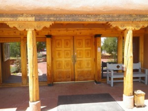
The visitors' centre had lovely architecture.

The visitors’ centre had lovely architecture.

Pecos pueblo taught me a lot about the geography of the region, the local peoples, the influence of the Spaniards on the development of the region, and more. I am leaving Santa Fe with a much better understanding of the history of this region and how it ties in to the history of my part of the continent. Thanks for another great recommendation, John!

Now, it’s time to move on. Work kept me up very late, two hours past my bedtime, last night, so I am up very late this morning and nowhere near ready to hit the road yet, but I am going! Next stop is Bandelier National Monument and then I’m pointing Moya towards South Dakota. I doubt I will get out of New Mexico today, but tomorrow will be a driving day.

A Four Letter Word Falling From the Sky

IMG_0545

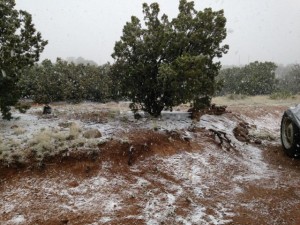
It’s really blowing out there and it’s COLD! Well, it’s cold outside. I’m cozy in the RV and barely having to run the heat. And I’m trying to figure out why I left my coat in the truck instead of having it in here with me. Not that I need to go out. I was thinking of going to a museum this afternoon, but things will have to change dramatically for me to go out there. 🙂 It is pretty, but considering that I was walking a coconut palm beach just three weeks ago, this is hard for me to wrap my brain around!

Home is much warmer right now and dryer and I’m ready to get to a lower elevation. I’ve been monitoring the forecasts through Colorado and I’ve decided to just take I-25 through Denver even though I swore I would never go through there again, at least not behind the wheel. But when it’s 27F in Breckenridge at 12,000′ and 57F in Denver at 5,000′, the decision is logical. I’m just not equipped to get trapped in cold snowy conditions since I don’t have proper footwear (no closed shoes, just sandals!!!!) and my truck handles poorly in snow.

Thankfully, the weather in the Black Hills appears to be clearing, so I should have a nice stay there. Just need to get through this final hump. Once again, I’m glad I have such cushy digs for riding out this weather that I knew was going to happen. May is such a fickle month for travel.

Preparing For the Final Push

John is graciously allowing me to stay through Monday. I am so grateful to have had this stop since the weather has been dire through Colorado, Wyoming, and southern South Dakota this past week. My host near Rapid City even got snowed in, or just about.

When I was planning the trip home, it was always my intention to spend the bulk of May in New Mexico, then pretty much canonball to the Black Hills as soon as the weather turned. So I’m actually right on schedule and about where I hoped to be on this date. I just didn’t expect to get such great digs in Santa Fe that would allow me a little breathing room to have so much fun!

I’ve got a few more outings planned for the weekend as well as a small project. I’m leaving not too late on Monday and have an excursion planned. Then, I’m driving. I have a back roads route planned through Colorado and Wyoming that will get me to the Black Hills by Thursday morning, even if I have delays because of weather. I really want to do the mountainous western route, even if it will mean worsened gas mileage, because I’ve been through the Denver area before. But I’ll monitor conditions and head towards an interstate if I need to.

But if the weather cooperates, this is what my route to the border looks like:

My clients are busy and I already have work for Thursday and Friday since my host will be working, too. Then, I’m taking the weekend off to go exploring with her and a friend (Mount Rushmore and Deadwood are on our list). Monday, I plan to head for the border, stopping at Devils Tower in Wyoming. And then Tuesday, I will hit the border when it opens, 8:00 a.m., and be home by 10:00 a.m., which should coincide nicely with Charles and Caroline’s morning coffee break. 😀

The weather in Santa Fe hasn’t been great, but the weather ahead of me is much more terrible, so I’m actually not that eager to get going again. I’ll need to pack my overnight bag for winter conditions and have resigned myself to the fact that I’ll be moteling it all the way to South Dakota. But thankfully, I have free accommodation through a very expensive weekend. My blog readers are awesome. I need to tell you guys that more often!

Kasha-Katuwe Tent Rocks National Monument

The nice thing about blogging about your travels is that when you get suggestions from local guides, they know what you like and can steer you in the right direction. When John told me to check out Kasha-Katuwe Tent Rocks National Monument I knew this was a must-do. It’s about an hour southish of Santa Fe, but only 45 miles, so not a huge time or gas commitment.

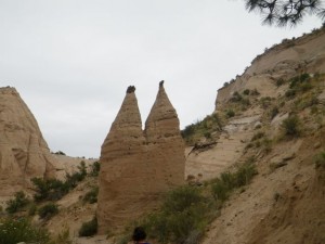
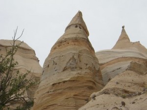
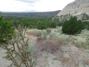
Long-time readers will find today’s pictures look a tad familiar. Indeed. Today was much like being back in the Alberta Badlands around Drumheller or Writing-On-Stone Provincial Park. The hoodoos here look different, more like Bedouin tents than mushrooms, but the stratified cliffs and scrub brush around them had a definite feel of ‘home.’

The weather looked iffy this morning. The forecast said no rain, but it rained hard mid-morning for a bit. When I saw that it was clearing somewhat, I decided to go and hope for the best. I’d done some research and thought that there was only a couple of short and easy hikes there, but it turned out that one was actually quite challenging, with a steep ascent and some scrambling. I definitely wasn’t dressed for that, nor do I have any rain gear, but I made do. I need to replace my hiking kit, but wanted to wait to make sure the weight loss held before I invested. Let’s just say that a major shopping trip at Cabela’s is in store for me this summer… I need everything, including a new small pack with an internal frame and, of course, rain gear. I may have to cave in the next couple of days and go buy something cheap at Walmart just to get me home.

But at any rate, I left around 10:30 this morning and had a leisurely drive to the tent rocks monument. There was a bit on the interstate, but most of it wasn’t.

Let me pause here to say I took about 500 pictures today, but managed to trim it down to 57… 🙂

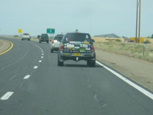
This vehicle made me laugh. The side of it had 'Official TARDIS chaser' painted on it and the license plate was T4RDIS.

This vehicle made me laugh. The side of it had ‘Official TARDIS chaser’ painted on it and the license plate was T4RDIS.

Entering the monument.

Entering the monument.

The fee station for the monument is about four miles before the parking lot. A Ranger took note of my pass number and gave me a receipt to leave on my dashboard as well as an information pamphlet. If you don’t have a pass, the cost is $5 per carload.

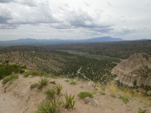
Very promising view from the parking lot.

Very promising view from the parking lot.

The parking lot was a bit of a disaster, with parking spots poorly marked. I finally slid into a space that I could get out of easily and hoped for the best.

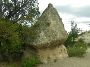
This little ball of rock dominates the landscape.

This little ball of rock dominates the landscape.

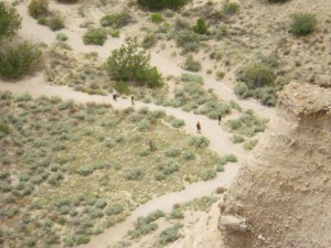
There are two trails, the gently sloping cave loop and the challenging canyon hike, which takes you through a narrow slot canyon, then has you scramble 630 feet in elevation to the top of the canyon for breathtaking views. I suggest doing the canyon hike then going back to the parking lot by the cave loop since that’s just an additional 0.2 miles.

I suggest doing the canyon trail, then returning to the parking lot by the cave loop.

I suggest doing the canyon trail, then returning to the parking lot by the cave loop.

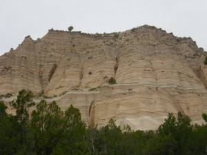
The layers include sand and volcanic rock.

The layers include sand and volcanic rock.

The tent rocks, or hoodoos, were formed from volcanic eruptions layering pumice, ash, and tuff.

First time I've seen a rest area before a trail. Had my lunch there!

First time I’ve seen a rest area before a trail. Had my lunch there!

Love the contrast of the greens and oranges.

Love the contrast of the greens and oranges.

Entering the slot canyon.

Entering the slot canyon.

Looks like the cliff got attacked by a woodpecker!

Looks like the cliff got attacked by a woodpecker!

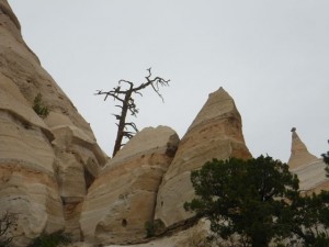
Amazing that the tree is still standing.

Amazing that the tree is still standing.

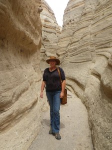
The slot canyon bit of the hike was memorable and probably not for the claustrophobic.

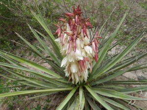
Neat plant.

Neat plant.

Cacti.

Cacti.

Going deeper into the slot canyon.

Going deeper into the slot canyon.

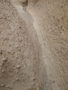
Narrow path!

Narrow path!

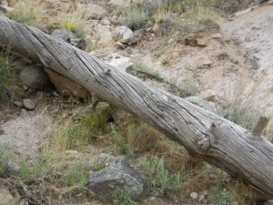
Another neat dead tree.

Another neat dead tree.

Not feeling a strong urge to experience Vermilion Cliffs National Monument...

Not feeling a strong urge to experience Vermilion Cliffs National Monument…

Not dressed for hiking, but at least I was comfortable!

Not dressed for hiking, but at least I was comfortable!

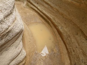
The puddle was a fun obstacle to cross.

The puddle was a fun obstacle to cross.

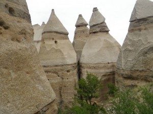
Looks like a castle with turrets.

Looks like a castle with turrets.

This one looks like an evil gnome!

This one looks like an evil gnome!

Some freestanding hoodoos.

Some more hoodoos.

You eventually start to climb out of the slot canyon to its rim and the hike gets progressively harder.

Beautiful with a barren quality.

Beautiful with a barren quality.

This tree seems to have something jackrabbit-like sitting in its branches.

This tree seems to have something jackrabbit-like sitting in its branches.

Bit of a scramble.

Bit of a scramble.

Um, wow.

Um, wow.

More flowers.

More flowers.

Look at them!

Look at them!

A lot of the trees here have twisted trunks like this one.

A lot of the trees here have twisted trunks like this one.

People started to turn back near the end, which was a shame. I can’t leave a trail unfinished and it wasn’t that hard, although there was one place where I had to pull myself up and my bad knee just would not follow the way it needed to and I thwacked it pretty hard on a boulder. I had to be extra careful after that, especially on the trip down, since the joint felt a little loose. Definitely time for me to shop for some sort of brace and I need to add hiking poles to my Cabela shopping list!

Climbing higher.

Climbing higher.

Still not at the top.

Still not at the top.

Prickly things.

Prickly things.

These red flowers really popped.

These red flowers really popped.

Still climbing.

Still climbing.

What a view!

What a view!

I eventually got to a plateau that still wasn’t the top, but gave a good preview of what was to come if I kept going. Knee not withstanding, I was in good shape, just a little out of breath from the altitude, but not excessively so. This is good acclimatization for Colorado!

This hoodoo has a hole through it.

This hoodoo has a hole through it.

Another dead tree reincarnated as a statue.

Another dead tree reincarnated as a statue.

Fuzzy flowers.

Fuzzy flowers.

What a climb, but so worth it!

What a climb, but so worth it!

Such wide open country.

Such wide open country.

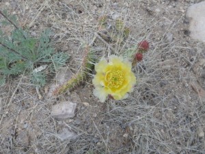
Cactus flower.

Cactus flower.

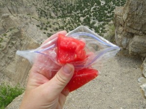
When I got to the top, I took a trail that went a little downwards to the very edge of a cliff and took a breather. I bought a watermelon yesterday (99 cents!) and a few cubes were exactly what I needed.

A much needed treat at the summit!

A much needed treat at the summit!

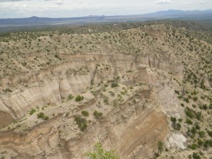
So huge.

So huge.

Climbing down this bit was the end of the road. I'm standing just off from a sheer cliff edge.

Climbing down this bit was the end of the road. I’m standing just off from a sheer cliff edge.

Hard to believe I was one of those ants an hour or so before!

Hard to believe I was one of those ants an hour or so before!

The trip down was slow. There was an older lady with a similar knee issue who got hurt at the same spot I did, so we watched out for each other all the way down.

Heading back out.

Heading back out.

It started to thunder and the sky looked ominous as I made my way back through the slot canyon. Seeing that I was picking up speed, a guy said quite rudely to me, ‘Relax, it’s just water.’ He obviously has never heard of flash flooding, nor did he read the signage at the trail head that said to get the hell out of the slot canyon in the exact conditions we were witnessing. Luckily, there was no rain!

I emerged from the slot canyon and took the cave loop back to the parking lot. At the junction of the two trails, it’s .5 miles to the parking lot the way I came or .7 by the cave trail

Colourful grass on the cave loop.

Colourful grass on the cave loop.

Low and behold, there was actually a cave on the trail!

Caveat (cave-ate) with soot on the ceiling.

Caveat (cave-ate) with soot on the ceiling.

Looking back to the cliffs.

Looking back to the cliffs.

This one looks like a mushroom.

This one looks like a mushroom.

Such interesting plants here!

Such interesting plants here!

This hike was a bit of a climb, but not a strenuous one.

Looked like a camp from afar!

Looked like a camp from afar!

This one looks evil. Can you see his eyes, nose, and creepy grin?

This one looks evil. Can you see his eyes, nose, and creepy grin?

Back at the parking lot, I decided to drive the 3.5 miles to the Veterans’ Lookout. Imagine my shock that the road there was in very poor condition, almost as bad as the Isla road, and there was no warning about that! I was fine in my truck, but I feel bad for someone in a small car or, worse, an RV towing something since there’s no place to turn around until the top.

But the drive up was worth it!

View from the veterans' lookout.

View from the veterans’ lookout.

Surprisingly nice facility at the end of a terrible road.

Surprisingly nice facility at the end of a terrible road.

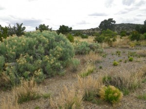
I love the vegetation around here.

I love the vegetation around here.

What an utterly amazing and unexpected day! It just goes to show that you can research something and still not ‘get it’ without being on site. I had no idea that I would do such serious hiking today, and what a treat it was! Kasha-Katuwe Tent Rocks National Monument is a place of incredible power and definitely worth a half day trip from Santa Fe or a day trip from Albuquerque. You can still get a heck of a lot out of the monument even if you can’t hike. The cave loop is not challenging and a good part of it is wheelchair accessible. You can also hike a little ways into the slot canyon to get a feel for it even if you are not able to climb up .

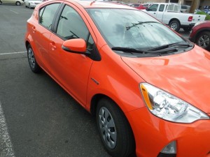
Finally, I saw this car in a parking lot in town and fell in love with the colour. 🙂

What a pretty shade of orange!

What a pretty shade of orange!

Not On Vacation

Whew, I just finished a pretty grueling work marathon, with the final lap being particularly brutal. It’s my fault for taking so many afternoons off to go exploring! I usually don’t work like this, taking half days off, preferring to get my work out of the way and then going to have fun, but I’ve been working around the fickle weather. It wasn’t particularly nice out yesterday and it rained all night, but it’s finally cleared a bit.

Today was a taking care of business sort of day. I needed to send something out for warranty replacement, so John’s Printing and Mailing Service dropped off a label I asked him to print, packing material, a box, scissors, and tape. I had my own Magic Marker at least. 😀
John vetoed my choice of post office since it’s just a counter and sent me to a proper one that he promised would have parking. I got there and there were about 15 people ahead of me in line and nearly as many ended up behind me since there was only one guy working the counter. It took almost 15 minutes before someone else showed up to at least process the people just picking up parcels, and then another service counter opened.

Even though I was only returning a small hard drive (barely bigger than a credit card), the box was pretty big to accommodate all the packing material they told me to use. So I was shocked that the cost to mail it was just $7.05. A similar box would have cost $30 to $40 to send a comparable distance within Canada. The clerk actually apologized for it costing so much! WHAT?! I mean, it’s going ‘priority’, which means it should be in Riverside in by Friday and I got a tracking number. What a good deal! I’m glad I didn’t go with UPS, which would  have been $$$. Western Digital gave me a discount for UPS, but it would have still been more than $7.05.

The post office wound up being a very good location since it was very near a mall that had everything else I needed for today, an ATM, a grocery store, and a sushi restaurant. 🙂

After lunch, I was thinking of going downtown to walk around, but the sky looked threatening. I was tired and still have a project left to do for tonight, so I just got my groceries and came home. BTW, I bought beer, assembling a really nice mix of six beers I’ve never tried, and did not get asked for ID for my first time ever buying booze in the States! Smart of me to let the grey hair at my temples grow, huh?!

Tomorrow should be a nice day and I have an excursion planned, thanks to advice from my local guide!