Visiting the Ruins of Dzibilchaltún

Today was the first day since I got here in May that I was caught up on my chores, my sleep, my work, and my financial goals and I really wanted to do something special. The obvious choice was to visit some more Mayan ruins. Thankfully, there are some only 30 minutes away!

Interestingly, my hamlet in SK is best known for being home to one of two sites in North America with petroglyphs on a horizontal surface. You could call that the “place where there is writing on the stones.” Well, Dzibilchaltún, the name of the Mayan city nearest where I’ve chosen to put down my first Mexican roots means… the “place where there is writing on the stones.” What a coincidence.

Dzibilchaltún is ridiculously accessible, just 5KM from the Progreso/Mérida highway on good roads.

Access to the site is quite pricy — $25 for parking + $142 for admisssion. Mexicans and permanent residents get free access on Sundays. There is no incentive for folks from the area who are temporary residents or who come down every winter. That’s rather a shame because it makes it less likely that I would want to come back here with guests. It would be nice to be able to buy a yearly membership or to get a break on admission for future visits as it’s such a lovely place to get out of the city.

From the parking lot, you take a meandering path in the forest to get to the ticket booth.

There was quite a bit of signage throughout the site in Spanish, Maya, and English. So any info I share is from there since I opted not to take a $350 (or 25USD…) guided tour. I learned a lot at Uxmal, but did not get much time to wander around. Today, I just wanted to enjoy being outside and poke through ruins at my own pace rather than hear a lot of information.

Dzibilchatún, with its proximity to the northern coast of Yucatán had both a marine and agricultural economy. The site was occupied from about 300 B.C. and was populated until the Spanish Conquest. It peaked from 600 to 900 A.D, with a population of 20,000. It was about 9KM square and had a concentric layout. The central part of the settlement had grand plazas connected by roadways in an area of 3KM square. It was in the central part that lived the administrative and religious elite. The population lived around the core. It was this population that contributed to change the concept of “ceremonial centre” to one of “urban centre.”

Here’s a map of the site:


Like at Uxmal, there are two separate fees to pay to enter the site. Here, I was able to pay the whole thing at one window and then collect my ticket at the second window. After that is a booth where you can hire guides and beyond that is a covered market area (very disappointing) and clean bathrooms.

Behind the entrance area, you can access the “archaeological zone.” To the right are the ruins I explore below as well as the cenote, which, unfortunately, was closed today. To the left is another ruin we’ll get to in a bit.

This is the area of the grand plaza. It covers about 12,240 metres and would have had a stucco floor (!). It was surrounded by buildings with stairs leading to the plaza. Most of the surviving buildings date to the early Middle Ages, 600 to 1,000 A.D., but a couple date to 1000 to 1200 A.D.

The cenote is a popular local swimming spot, but it seemed a bit uninviting to me.

Can you spot the giant iguana?

On this site are the ruins of a 16th century chapel. As a reminder, that’s the time of the Renaissance. You don’t need to go to Europe to visit old buildings!

These are part of the ruins of a 17th century ranch.

I must have been a mountain goat in a past life. Up I went!

I’m starting to think about getting myself a selfie stick. Not. 🙂

The wooden lintels make me suspect that these structures were also part of the ranch.

Back of the chapel.

There were way too many people to climb the pyramid, so I decided to head to the other part of the site.

It was only about 10:30 and while the sun had been unrelenting since I’d gotten up at 8:00, there was a wonderfully cool breeze running through the site, making it very comfortable. I walked on a 20 metre wide road called a “sacbe.” It begins at the east of the central square and connects 400 metres later with the building called the “Seven Dolls.” The road was mainly in use from 600 to 100 A.D. There are 11 of these roads in Dzibilchaltún, all beginning in the centre and going to peripheral structures, giving the site its urban character. The inner roads have been interpreted as evidence of ties between families.

I took a short detour into the woods to see what’s left of the housing complex, a cluster of buildings in an area of about 4,000 square meters. The dwellings had different heights, speaking to different social status. The inhabitants were buried beneath the floors of the platforms. There really wasn’t much to see, but I enjoyed the shady trail.

Back at the main road, I came across Structure 12, a quadrangular platform with access points on all four sides. Upon it is a monolith, which would have been decorated with stucco and functioned as one of the 20 stelle on the site.

In front of the Seven Dolls are three adjoining rooms aligned with a double open hall. To the south is another double room and to the east a single room. They were inhabited circa 800 A.D. Beneath their floor were offerings of shells, fishbones, stingray tails, small objects made out of green stones, grey obsidian, and other marine materials.

The Seven Dolls building owes its name to an offering of seven coarsely made dolls found inside. It is a one-story quadrangular building with a central chamber surrounded by a corridor. The roof was tower-like and it projected itself upwards from the vaulting. It had four access points and a window to the side of each entrance facing east and west, giving it the characteristics of an astronomical observatory. It was constructed on a pyramidal pedestal, with sloping corners, with sets of steps on all four sides. The frieze of the building was decorated with eight stuccoed masks upon a base of carved stone, two intertwined serpents and glyphs, and beads, feathers, and sea creatures in modelled stucco. Towards 800 A.D., it was filled with stones and covered by another, larger, building, whose remains still partially cover it.

I then headed back towards the entrance to find the museum, when another stone structure caught my eye. I quickly realised from its roof that it was a tad more modern! 🙂


The museum is in two buildings, is small, and is really informational. The Grand Museo del Mundo Maya is really a must, but this little museum does a great job of giving the folks who are coming to Dzibilchatún as a day trip from the cruise ships a primer on the Mayans.

The museum starts by situating the Maya in their geographical context, explaining that there are very distinct ecosystems in their world. Where I am, in northern Yucatán, is more desertic and flat, but you get into mountains and rainforests as you move south towards Honduras.

The serpent is a very important part of their mythology.

This is a hoop from a ballgame that I learned today was usually a prelude to human sacrifice.

Map of Mayan settlements in Yucatán. I still can’t believe that I was taught in school that there is no history in North America before the Europeans came.

There are a lot of parallels between the Maya and the Egyptians, such as the fact that they wrote in hieroglyphs set in cartouches. The Dresden Codex is the Maya equivalent of the Rosetta Stone that decoded Egyptian hieroglyphs.

Pretty purple flowers by the entrance to the second half.

While the first half was about the Maya in general, the second half was more about Dzibilchatún and also the Spanish Conquest.

Here are the Seven Dolls!

I’m not going to retype all of the information I got in the museum, but here is something of particular interest. “Scarcely five metres above sea level, very close to the coast, located on the difficult, calcareous and porous soil of north Yucatán, Dzibilchaltún is an example of a successful Maya urban dwelling. It was a challenge to life. Without rivers to justify the decision to build, its inhabitants obtained water from more than a hundred wells and some neighbouring sinkholes. The largest of the later, the cenote of Xlacah in the very centre of the city, quenched thirst of rulers, priests, merchants, and pilgrims.”

The section about the conquest was very well done, showing how the Maya evolved and yet kept old traditions and knowledge alive.

The Maya were expert stone craftsmen and their “artistic ability was demanded as tribute,” to build churches, mansions, streets, and aqueducts of Spanish towns.

I’m trying to remember where else I saw this system of currency, where employees of a hacienda were paid with tokens that could only be used at that hacienda’s store.

A bale of henequen, which is an agave (yes, the same stuff used to make tequila).

Very old map of Mérida.

There was an ecological path outside of the museum… that was closed. 🙁

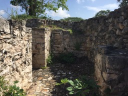
There were a couple of dwellings to check out.

There’s an impressive meeting area with a woven roof.

And a lovely covered walkway back to the main entrance.

I spent about two full hours at Dzibilchaltún, which was plenty for me. I learned a lot about the geography of Yucatán, more about the Maya, got to explore some ruins, spent some time outside, and got scratches and bruises from my adventure. I’d call my morning seized. 🙂

It was still breakfast hour at this point (just before noon), so I had no trouble finding myself some tacos for lunch.

Al pastor tacos in Yucatán are very different than in Sinaloa. I haven’t decided yet if I like them as much or if I need to find a new favourite taco. But these were really good. I couldn’t believe I got all this (which has a very generous portion of Tex-Mex style guacamole under the totopos!) and a real strawberry agua fresca for only $79.

Since I was practically in Mérida, I did a quick blip over to Costco. I was amused to find actual Korean people (there is a sizeable Korean community in Mérida) debating the possible merits of the very kimchi dumplings I was coming to pick up. They put them back…

I got in around 2:00 and by the time I’d played with Puppy and had a swim, it was time for a long chat with a friend by phone, then dinner. It’s now almost 9:00. I forgot how long these posts take to write! At any rate, I hope you enjoyed my morning at Dzibilchatún as much as I did!

Lunch at Café Stash and a Play at the Centaur Theatre

Thank you to everyone who checked in to ask if I’m still alive. Work has been a tad… busy. But I decided to take today off so as to accept my cousin Lee’s invitation to join her for a play this afternoon. She’s the cousin who visited me in Maz my first winter there. She has a season’s pass to the Centaur Theatre and with that, she gets one complimentary guest pass for any show. Aren’t I lucky that she invited me?! The Centaur Theatre is an icon on English Montreal and the premiere English theatre in the province. I hadn’t been in about 20 years, but used to go often when I lived in the area.

To my surprise, there are hourly buses to Montreal from Chambly on Sundays. I was  meeting Lee and a friend at noon for lunch and had a choice to leave at 10:05 and arrive around 10:40 or leave at 11:05 and arrive around 11:40. I picked the first option so I’d have a leisurely stroll from the bus station to the restaurant (about 20 minutes) and then be able to walk around the neighbourhood.

On the way, I saw that construction is underway for the replacement to the Champlain Bridge. I cannot believe that the bridge is already obsolete when we were paying tolls until 1990 to use it.

Approaching the terminal at 1000 de la Gauchetière, the building I think looks like a carpenter’s pencil.

Doesn’t it?

From there, I headed down Mansfield towards Old Montreal, parts of which look a lot like Europe. There are buildings dating back to the late 1600s!

I found my lunch destination, Café Stash, without any difficulty. I was a full hour early, so I made a note of the location and then continued down rue St. Paul Ouest to a café.

I settled myself with a cup of coffee and one of the trashiest newspapers in the city, Le journal de Montréal. There was an interesting article about Cuba courting Quebecers for medical tourism. Healthcare here is so bad, with terrible wait times and many people not having a family doctor (I was something like 157,000th in line for a family doctor in Quebec the last time I tried to get one, circa 2004). I’ve been looking at basic (emergency) health coverage in Mexico and while most Canadians find it inadequate, Quebecers generally praise it.

A bit of good news is the the drought crisis in California is officially over.

I lingered at the café a full 30 minutes and then went out to enjoy the first sunshine I’ve seen in about a week.

This is the Pointe-à-Callière archeology museum. Last time I visited was way back in 2010.

A very European-looking alleyway.

I loved the contrast of new and old here.

Isn’t this a pretty building?

I finally met up with Lee and her friend at Café Stash. She and I were famished and went with the “table d’hôte,” which is a set menu for a fixed price. I’m sorry I didn’t take pictures, Vicki, but here’s what I had:

-barszcz (beet consommé, which was unbelievably deliciously. Nothing at all like the thick Russian borscht I was expecting);

-two kielbasa sausages (served with Dijon mustard) with boiled potatoes (that I doctored with sour cream) and sauerkraut;

-coffee

-apple crumble.

Lee had their sampler meal with a bunch of different things and graciously passed over one of her precious pierogis for me to try. She went with the peach crumble for dessert. By the way, she considers Stash her favourite restaurant!

Her friend had two cabbage rolls with beet salad (cold) and boiled potatoes and said his food was excellent.

My menu was priced at $25, but, of course, you have to add 30-35% to prices when eating out in Quebec (15% for taxes and a 15% to 20% tip) so my total was $33, which I found to be really good value!

We then had a very short walk to the Centaur Theatre. It really hadn’t changed since the last time I was there.

The play we saw was “Clybourne Park,” which is both a prequel and sequel to “A Raisin in the Sun.” It is a tale of race relations, gentrification, and how the more time progresses, the less things change. It was funny, shocking, and sad. I’m actually surprised by how much I loved it, considering I knew nothing about the source material. Most surprising, I came out of it even more certain of the kind of expat I do not want to be when I settle in Mexico.

The play finished around 4:15, so I didn’t have time to make the 4:35 bus home. With the next one being at 5:35, I decided to accompany Lee and her friend to a nearby Tim Horton’s by a métro.

There, I picked up a wonderful Earl Grey tea to go since Lee and her friend decided to walk with me to Place Bonaventure since her friend was catching a bus from there as well and Lee could take the métro. By the time we arrived and said our goodbyes, I only had about 20 minutes left to wait for the bus and there was free wifi.

I took the above photos with the camera on my new-to-me iPhone 6, which I was able to get since I got a free flight home to SK with my travel reward points and therefore had some space in my budget. I cannot believe how much of an upgrade this already obsolete phone is! I was out all day with it and didn’t even lose 50% of my battery capacity. It is very responsive and has some nice features like iTouch (signing in with just a fingerprint), a bigger screen than my 5C, and Apple Pay. I’m super happy with it and glad that I’ll have a reliable phone for my upcoming insane journey across two of the biggest countries in the world.

So it was a great day in downtown Montreal. My time here is winding down, but I have a full week left. The way things have been going, it’s going to be pretty much nose to the grindstone the rest of my time here!

English Sun Is Particularly Lovely

Today was so lovely! It felt like a proper late spring day. Landing in snow and freezing weather on Wednesday afternoon is going to be shocking!

Since the weather was so suitable for exterior line drying, my wonderful host suggested I throw some of my laundry in with hers today. How thoughtful! This way, I won’t land in Montreal desperate to put a load on. Let me tell you, I’m more than a little tired of wearing the same clothes every day…

I had so much work to do ahead of my time off, but I couldn’t spend all of today indoors. I powered through a a large file due at 3PM and was able to head out just before 2PM for lunch and a walk around Hove before going back to work. Tomorrow, my last day (!), is going to be a proper exploration one, but I am going to  fit in a couple final hours of work.

But at any rate, a two-hour lunch break today was definitely in order. I was quite famished since I was well past my lunch hour. So when the second restaurant I passed after the train station had a £5 burger special for takeaway, I was set. I figured based on their menu that this would be a high quality, healthyish, burger and I was right. It was very plain, but was a nice juicy piece of 100% beef and it had lots of veggies on it. I wish I’d thought to ask for some sauce on it, but it was pretty good on its own and wasn’t too heavy of a lunch.

I then decided to wander down a main thoroughfare and then head down to the water to come back the way I came by a different route.

I passed a really pretty church made of flint, just like the Lewes castle.

That’s a florist set up in front of it.

This pub had a striking façade. The sign at the top says “The Wick Inn — rebuilt in 1873.”

Just as I was thinking of turning back, I discovered a gelato shop! I sure wasn’t going to turn down a chance to eat an ice cream by the beach on such a warm and sunny day! They had so many flavours, but the hard to find chocolate-orange was an obvious choice.

I headed towards the water in front of the rows of beautiful houses. Turns out they all have ground floor flats, most of which have beautifully tiled courtyards. The flats must be rather dark on an average day, though.

There are so many beautiful churches in Hove. Here’s another one I passed very near to home.

And here’s a map of my walk. I didn’t realise I’d covered so much ground. 3.9mi is just over 6KM!

I came in and got right back to work, stopping around 6:30 to heat up the other curry I bought yesterday. It was another fantastic one. Oh, Tesco, I will really miss you. I then put in another 1.5 hours of work before having a shower and watching on the ITV website the last episode of Broadchurch I’ll have easy access to.

Now, it’s time to do a little research about what I’ve bought tickets to see tomorrow! 🙂

A Self-Guided Tour of the Pocket Parks of Shrewsbury

I don’t know if it’s because my time here has come to an end, but getting up this morning was just about impossible. I am absolutely exhausted and looking forward to a very long lie-in my first morning in Brighton. It’s a good thing my last day in Shrewsbury was sunny, otherwise I would have been tempted to not do my final walking tour and instead just spend the afternoon on the couch cuddling Puppy while watching movies!

But it was a beautiful day, so I set off late morning to do the Pocket Parks of Shrewsbury walking tour. We’ve been to most of these stops before and this is the first tour where I wish I’d followed my instincts and done it in my own order since I ended up walking all over town, sometimes for almost nothing, and having to backtrack to get home. The exercise was good, of course, but things were getting rather repetitive. Still, there were a few stops on this tour that were unique and I caught new things even at places where I’ve been.

Here’s a map of the tour (click to embiggen).

“There are several small green havens of peace in Shrewsbury town centre, quiet places to sit, rest, or have a sandwich. … Most are tended by the Town Council gardeners who call them pocket parks.”

So the tour starts at St Alkmund’s Churchyard, where we’ve been countless times. I made it a point to walk around and catch different perspectives.

“St Alkmund’s Church stands on the flattened top of one of the two hills within the river loop, looking as if perched on a pedestal. A Saxon church was once on the site, but the current building dates from the 1790s, except for the tower, which is late 15th century. From Saxon times until 1261, the King’s Market was held here in the space around and between this church and its neighbour, St. Julian’s.”

Note “the unusual 18th century cast iron windows…”

I loved the pretty turquoise front door.

The pub is called The Three Fishes.

Notice a discrepancy between the church and street signs?

Both spellings appear to be used interchangeably.

From St Alkmund’s, I moved to St Julian’s Detached Churchyard, which I was curious about and would be a favourite spot for me to sneak to on a lunch break if I worked in the area.

“This was founded in the early 1800s when John Oakley, a local grocer, sold part of his garden to St Julian’s Church as an extra burial ground. There was a great shortage of burial space in town centre graveyards at this time. He and his wife were buried here; the last burial, in 1881, was of his daughter at age 81. A century later, the Town Council took over the care of this graveyard and it has become a quiet secluded pocket park minutes from the bustle of Wyle Cop. The tombstones seem to form a paved area…”

I occasionally see signs like these in England, making it easier to navigate towns with no street pattern.

Next stop was Old St Chad’s Churchyard, where I spent so much time on the tour of the Shuts that I did not go back in as I did not learn anything new.

The leaflet did make me notice this building across from the chapel. This house “illustrates a fashion that was common in the town in the 18th century. At this time, houses were sometimes modernised by brick skins and plaster to cover the ‘old-fashioned’ Tudor timberwork.”

It was then quite a long stroll to my next destination, about a block from the abbey. On the way there, I discovered that the route to my next destination was blocked.

The reason why became apparent very quickly. I didn’t realise it had rained so much in the last few days!

The tow path is fully immersed.

I crossed English Bridge and immediately turned left into the Abbey Gardens.

“These once belonged to the builder John Carline. He and his business partner John Tilley were responsible for building the Welsh Bridge. Carline and his family had a house at the side of the plot away from the river. In his riverside yard, he kept materials, pieces of fallen masonry, and his models of the lions for the base of Lord Hill’s Column; they are still here. At one time, this park was also known as Mr Palin’s Pleasure Gardens; residents came here to walk and admire abandoned pieces of sculpture, which were on display. Many of them are still here. The park is now known for its rhododendrons and azaleas in the spring. From this park, there are excellent views of the 18th century English Bridge, the river itself with its old towing path, and above it a silhouette of the town centre, including the old Royal Salop Infirmary, founded in the 18th century and now converted into flats and shops.”

I love that detailing on the stone columns. Can you see how twisted they are?

I couldn’t get over how lush and bright green everything was!

Daffodils!

A crocus, in early March!

A large part of the garden was under water!

I had to make my own way to my next stop, easily done as I now know my way around the downtown core. I followed the route along the water on the medieval tour, so I didn’t miss anything.

I thought this building had a rather lovely curve.

I was feeling peckish and decided to get a snack to tide me over to lunch. Café on the Cop looked inviting and had a cream tea for just £4 (for which you could have tea or a pot of coffee!). That was exactly what I wanted. I came in and took a seat and was immediately taken in by the unusual slate place mats.

The very sweet proprietor came over right away for my order. I decided on tea rather than coffee as the latter just didn’t feel right with this snack.  I was not offered a choice for the type of tea and whatever it was that came was very lovely. But now, check out my scone!

It was huge! It was equivalent to two scones anywhere else I’ve had a cream team. Needless to say, this became an early lunch! The preserves weren’t the best I’ve had (a jelly rather than a jam), but the scone was the best ever and the clotted cream hit the spot. I did not have the butter. This was definitely my favourite cream tea of the four I’ve enjoyed since discovering this treat at the British Museum.

My next stop was the castle! En route, I got very close to the yellow house we saw on the Tudor tour.

I got a good view of the library across the way.

What an impressive flower arrangement! Can you see the Union Jack?

The castle is now the Regimental Museum, for which you have to pay. But it’s free to walk around the grounds.

“This pocket park is part of the Norman castle built in the narrow neck of the meander by Roger of Montgomery, a relative of William the Conqueror.”  The castle was once connected to the town walls by a sandstone wall.

“Edward I added to the castle, building the great hall in the 1280s, when it was a link in the chain of castles guarding the Welsh border. … In the 18th century, the castle was remodelled by Thomas Telford for Sir William Pulteney, the wealthy owner. He also built, on the old motte, a summerhouse-folly named after Laura, Sir William’s daughter.”

That was my next stop, Laura’s Tower. Up I went!

I love how that stone has been worn from so many centuries of folks treading on it.

Laura’s Tower.

Unfortunately, you can’t go in, but you do get an incredible view of Shrewsbury.

The abbey.

I headed back down to walk the grounds a little.

More daffodils!

The next stop was the library garden and I wasn’t going to bother since there was no new information, but then I saw an interesting tidbit. So off I went to look at the turnable, “which was installed in 1983 to rotate library vans.”

I did pop into the garden to admire the flowers that were blooming. The garden was “planted to give all-year-round foliage colour with minimum maintenance.”

It was another long way to my next park, which we’d been to on my first day out and about in town. Spoiler: both were closed. 🙁 I would have been better off coming straight to the last one from the Abbey Gardens and finishing at the castle. But anyway… I love this shot of Castle Street. It just looks so… old!

Shrewsbury bus station.

St Chad Church in the background.

Welsh Bridge.

I came to find a locked gate the Quantum/Mardol Quay Garden. But I could at least see things from the street.

“This pocket park is located on the site of the Mardol Quay, built in 1607. Some of the original cobbles can be seen and here river boats loaded and unloaded — old accounts show that ‘for every barge load of wood or coal 12d; for a ton of other goods — from a burgess 2d and from a foreigner 4d.” Later, the warehouses were converted into a car repair shop, which eventually was cleared for road widening in 1958/60. A public garden was established on the riverside, which was redesigned in 2009 for the bicentenary of the birth, in Shrewsbury, of Charles Darwin and the 150th anniversary of the publication of the The Origin of Species.”

Remember this odd thing?

“A sculpture, designed by Pearce and Lal and called Quantum Leap, has been likened to a shell, human vertebrae, DNA, and many other things and is locally known as The Slinky because of its similarity to the coiled-wire toy. The garden celebrates Shropshire’s geological history….”

I passed the Rowley House yet again on my way to my last stop, capturing it from a new angle.

Narrow driveway entrance.

Getting closer!

St Chad’s Church “with its adjoining graveyard was built in 1792 to replace the one that fell down. From the churchyard, you can see the unusual circular shape of the church, the largest of its kind in England. In the middle of the 19th century, as a result of the crowded and very unsanitary conditions in town centre graveyards, a Burial Act was passed closing urban burial grounds. As a result, in 1856, the General Cemetery was opened on the outskirts of the town with cooperation from all six parishes. The churchyard is now maintained, as a semi-natural woodland. In the centre, look for Scrooge’s gravestone, placed here for the filming of Dickens’ Christmas Carol in 1984.”

Well, the churchyard was closed. 🙁 A very kind worker came over and said to me, “Sorry, lovie, they’re doing works inside.” Lovie? I love British endearments!

So this is all I saw of the churchyard.

The church itself is large and impressive.

Its vicar is well-named.

Main entrance.

Across the street, balustrade paid for by the Horticultural Society.

Across the street is the unassuming final stop, The Dingle.

I really love this church!

Another vantage point of the hospital.

I headed home after, going all the way back up Pride Hill and down Castle Gates, which I’d done twice before already today. In desperate need of a haircut, I popped into a salon with a sign that said walk-ins welcome. I found that £15 was very expensive for the little work they had to do (I just shear the hair very short), but needs must and I felt much lighter when I got out.

I took the route by the train station to go home from there and it was after I did the turn at Morrison’s Lubricants that I noticed this door for the first time. Very curious.

Well, thus ends my lovely stay in Shrewsbury! I adored this town! Hebden Bridge was cute, not somewhere I would have wanted to be for long. I could certainly see myself in Shrewsbury.

The puppy sitting was restrictive, but it was a blessing in a way in that it forced me to stick close and really get to know the centre of town. There is so much of Shrewsbury that I did not see as I did not venture much on the other side of the river, but I definitely covered the touristy part of town and then some!

I’d consider the puppy minding part of the exercise a success. I know I did a very good job of it and I’m very proud that. It was very challenging, exhausting, and sometimes tedious, but it was also immeasurably rewarding and I can’t remember the last time I laughed so much with such joy on a daily basis.

So I’m heading out tomorrow at about 1PM and as long as I make my super tight connections (not counting on it), I’ll be in Brighton by 6PM. If I do make my connections, I’ll be pulling out of London Bridge in exactly 24 hours and 10 minutes for the final leg of my journey across this country.

My route ahead isn’t nearly this directly, but is well represented here.

The Victorians in Shrewsbury, a Self-Guided Walking Tour

Having completed the Tudor tour of Shrewsbury, I headed back to the Music Hall to commence the Victorians in Shrewsbury self-guided walking tour.

“Queen Victoria reigned from 1837 to 1901. These were years of peace, prosperity, population growth, invention, and expansion. Shrewsbury was not one of the boom towns and, although some working class estates and substantial middle class villas were erected in the suburbs,” the tour was limited to the town centre and its then new public and commercial buildings. “Many were built of high quality materials and were very varied in style because, of course, architectural styles did not change with the new monarch. Queen Victoria’s reign was also a time of greater regulation, moral certainty, growth of religious non-conformity, and considerable philanthropy.”

So the first stop was the Music Hall itself, where we finally get some information about it. It was “built in 1838-40. It looks classical and Greek and was known at first as Shrewsbury Public Rooms. It was built around a shut that led to a yard where engines of the Salop Fire Office were kept; this is now the entrance to the museum. The Music hall, with a choir and orchestra gallery, was to the left. The hall could seat nearly 800 and was also used for balls, banquets, lectures, meetings, and bazaars. … To the right of the shut, now the Visitor Information Centre, was the rebuilt Salop Fire Office; while a News Room occupied the elegant room on the first floor overlooking The Square, and a billiard room the floor above.”

It was this tour that finally gave me information on the unmarked statute at the front of The Square. Sorry for the wonky angle; there was a display in front of it.

So that’s Clive of India. “The Victorians decided to commemorate him, although his influence had been 100 years earlier in Georgian times. The sum of 2,000 guineas was raised by public subscription and Carlo Marochetti sculpted the figure, copying the likeness from a painting by Nathaniel Dance. In addition to his exploits in India, Clive was mayor in 1762 and M.P. for Shrewsbury three times. The statue dates from 1860.”

Across from Clive is a building in what I’ve learned is the Flemish style and which was built in 1892 from high quality materials for the Alliance Assurance Company, which is now the Halifax Building Society. “The carvings commemorate the companies that were incorporated into the Alliance at its creation.”

Next stop was the Victorian post box in front of Gullet Passage. It is late Victorian, hexagonal, and made of cast iron. It is called a Penfold box, after the designer. It would have originally been green since the boxes were only painted red starting in 1874. “Pre-charged mail, based on weight, was introduced at the very beginning of Queen Victoria’s reign and the volume grew dramatically from 76 million letters in 1839 to 350 million in 1850!”

On the way to the next stop, I was told to look at Claremont News, which has a typical Victorian small shop façade.

Next up is the Baptist Church, “which has recently been repaired and cleaned.” It “is very classical and less ornate than was usual for its date. The hard red bricks came from Ruabon in North Wales and were very popular at this time. … Here, they are paired with Grinshill stone, a local grey sandstone, to pick out the round-headed windows and Corinthian pilasters. This church cost £2,500 to build in 1878.

There is a lot of walking between stops on this store, so I had time to notice other things.

I have one of those…

These steps look very precarious.

Next up was The Quarry and the entrance to Wonderland…

AKA The Dingle.

St Chad’s Church

Entrance to Wonderland/the Dingle. As you can imagine, my expectations were low.

First glimpses of this faery tale world before the bla bla bla.

Looking back to the entrance from which I came.

“This is the Dingle, created from a quarry, which produced building stone for the early town. Long abandoned, a pool had formed in the lowest part and was used for watering cattle; one old photo shows children skating here during a cold spell. The quarry was landscaped in 1879, with a path and shrubs around the lake and a more formal area of flower beds that are replanted seasonally.”

The Dingle is the last stop on my next tour, so here is more information from that guide: “Although the rest of the Quarry was laid out as a park with an avenue of lime trees by the Corporation in 1719, an early photograph shows the Dingle as a ‘wild’ area, with a natural-looking pool; Charles Darwin is said to have fished there for newts. … The fountain in the centre of the formal flower beds was given to the town in 1889 by the Independent Order of Oddfellows. The gardens are a Percy Thrower legacy … He was park superintendent from 1946 to 1974 and became known nationally as the TV gardener. The Dingle is the jewel in the crown of the Parks Department, … each year it is brought to perfection for the Flower Show in August. Trees in the Dingle include Maidenhair Tree, Sweet Gum, Ginko, Tulip Tree, Swamp Cyprus, and an enormous mature Beech.”

Back to the Victorian guide, “At the far end of the lake is the statue of Sabrina, Goddess of the River Severn, now reclining in her own grotto…. The Earl of Bradford presented her to the town in 1879.”

I had fun watching the ducks for a bit.

Interesting artwork in a tree.

What an amazing spot, like a miniature Buchart Gardens.

I reluctantly left The Dingle and found the cast iron bandstand that dates from 1879 and which in recent years has been revived every odd Sunday afternoon

Across the river is the Pengwern Boathouse, with its typical Victorian architectural style.

“The Boat Club was founded in 1871 when rowing was very popular and it had racing boats as well as a number of pleasure boats. It moved to these premises in 1881 and still flourishes, holding a popular regatta in May.”

Very near the stop where I took the boathouse pictures, I came across this stout post just before the Kingsland Bridge, which you can see in blue in this picture. “This is an old ferry post, the windlass can be seen set back above some steps on the other bank. There were several of these pedestrian ferries in central Shrewsbury, which saved people a long walk to either the Welsh or English Bridge. This one was superseded by the Kingsland Bridge in 1882, which gave access to the fine Victorian suburb of Kingsland and the new Shrewsbury School. … The bridge, known locally as The Penny Bridge, as it charges tolls, has always been privately owned and operated. The ferry remained for some years and the boys from Shrewsbury School used it to avoid paying the toll to cross the river.

I now had a very long stroll ahead along the water, so I took the time to enjoy the surroundings.

Back of a structure we will see from the front…

Kingsland Bridge.

Looking to the centre of town. Notice the cathedral. That’s my second to next stop!

The Greyfriars pedestrian bridge, where I turned left to begin a surprisingly gentle climb back to town.

But first, this obelisk, “in memory of Dr W J Clement, a skilled and innovative surgeon, philanthropist, a long-serving local councillor, mayor, and for a while M.P. for Shrewsbury. He demanded reform of rotten boroughs, thus antagonising the Tories who dominated the Corporation. In return, they refused him a post at the hospital. … The memorial was erected in 1873 and was originally outside the railway station, but has been moved several times.”

Off I want to the cathedral, marvelling that I was all the way down there just moments before.

“The steep-gabled, neo-Gothic church is, in fact, the Roman Catholic Cathedral. It was started in 1853, only 20 years after the Catholic Emancipation Act and soon after the restoration of the Catholic hierarchy in Britain. … The limitations of the site led to some alterations to the original plan; the tall spire was replaced by a bell-cote and the chancel is very shallow.”

Looking back along Town Walls. If you keep going, you can turn left to take Wyle Cop to go back to the centre.

Looking ahead. I found it interesting how the sidewalk was so far up the road as to need a railing.

This is a water pump. There are several in Shrewsbury and they are all listed by English heritage. “They day from 1870 and the inscription encourages the careful use of water; the basin at the base catches any waste, which can be used for animals.”

Door to the watchtower. There is no information about this building on this tour, just its name.

The watchtower.

Looking towards my next two stops.

First is the girls’ high school.

Can you read the sign?

The high school was built in 1897-98. “This independent school is part of the Girls’ Day School Trust set up in 1864 following a National Enquiry, which concluded that there was ‘a general deficiency’ in the provision of secondary education for girls. The aim was to provide a high standard of academic, moral, and religious education for all social classes.”

Next is the magnificent neo-Gothic building we saw the back of down by the river, the former Eye, Ear, and Throat Hospital, opened in 1881, and now converted into flats.” I know where I’m moving to… 😀

“Its construction was a great example of Victorian philanthropy, ‘upwards of £12,,000 being raised largely through public subscriptions. … The cantilevered operating theatre windows on the second floor were originally glazed with single sheets of plate glass to provide maximum northern light for operations.”

I then turned up Swan Hill to get to my last destination.

This wasn’t on the tour, but was pretty.

The final stop is the Italianate former Police Station/Weights and Measures Office, built in 1893 “to house two important new services that were to be carried out by the local authority. The provision of a police service was made compulsory in 1856, though Shrewsbury was ahead of the game, having appointed 13 constables 20 years earlier.”

“In relation to the weights and measures, there were many attempts throughout the Victorian period to standardise weights and improve the standards of retail transactions. Between 1878 and 1893, new mechanisms for inspection and enforcement were established.

Thus ended the delightful Victorian tour. I think this was my favourite!

Heading home up Pride Hill, I was shocked to find that the McDonald’s had closed permanently. Am I glad I was able to visit its basement before that happened! I hope that Shrewsbury will not permanently lose that important landmark.